CHAMPI
Cat2 Cat2 ·85 kt ·12.4°N, 148.6°E
1 active system(s) · ensemble guidance from 9 models, refreshed every 10 minutes.
We track tropical cyclones at the intersection between artificial intelligence and physics — every ensemble member, every 10 minutes, side by side with the official forecast.
Active systems
Genesis potential
Forecast models
CHAMPI
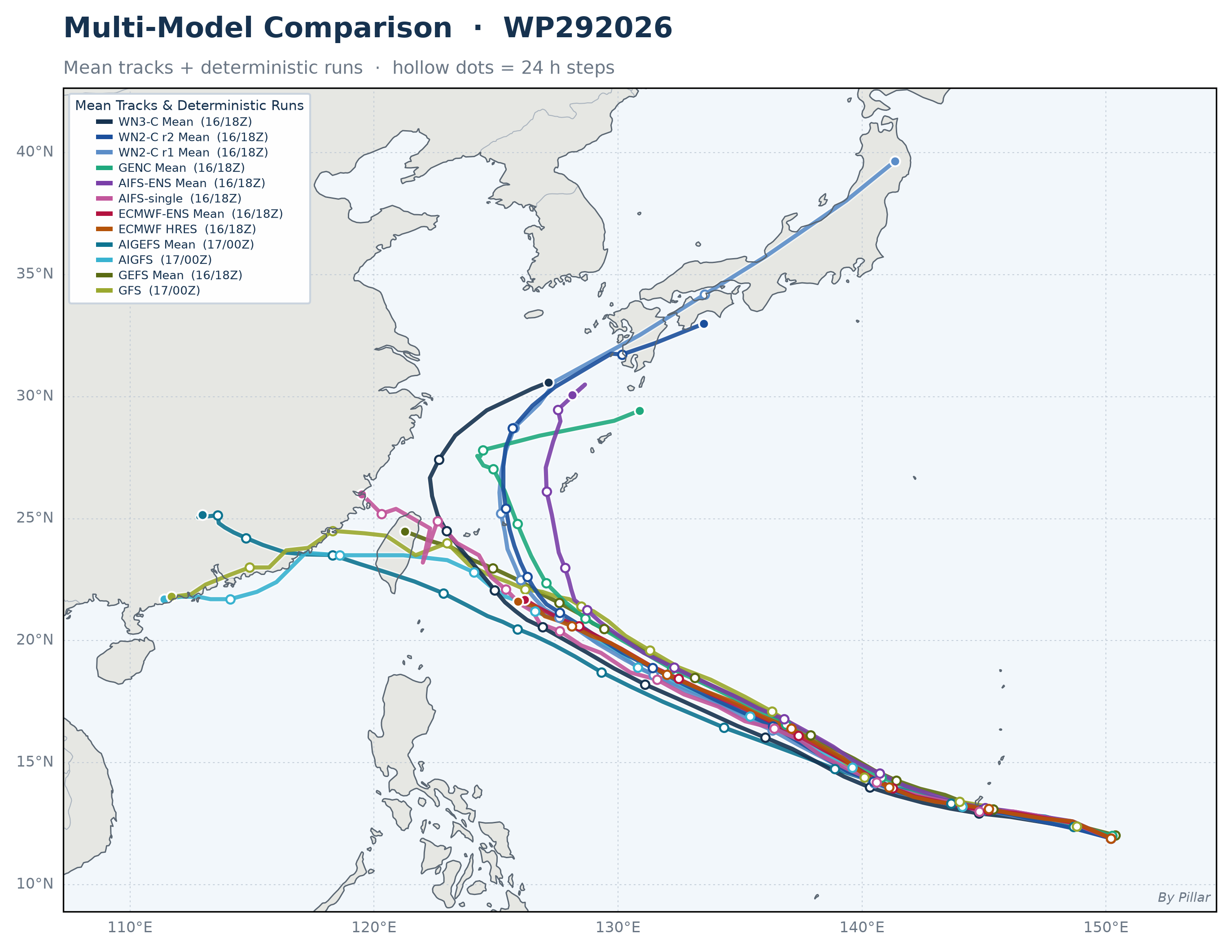 🔍 Click to enlarge
Ensemble mean tracks and deterministic runs from every model on one map · Hollow dots = 24-hr steps · Parentheses in the legend give each model's initialization time (day/hour Z)
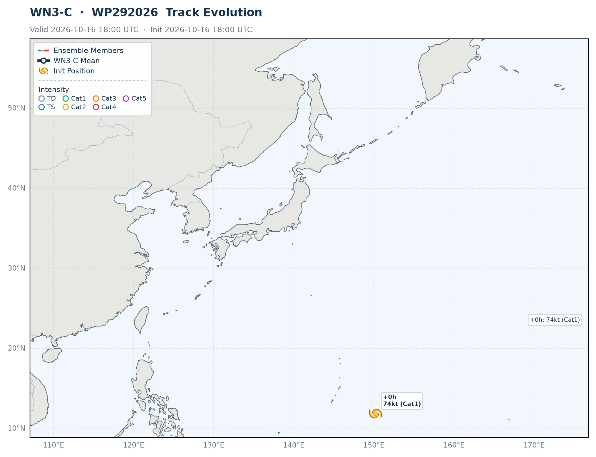
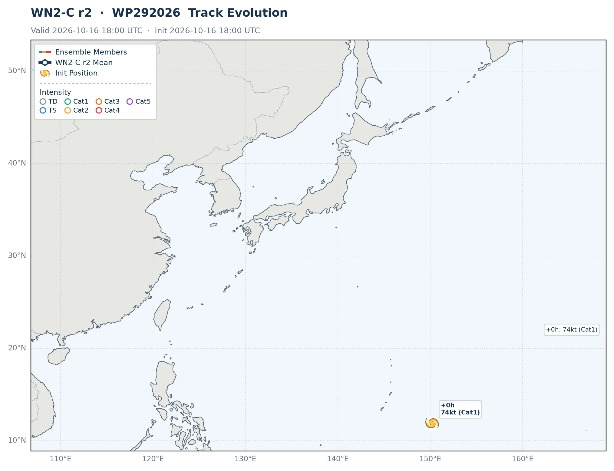
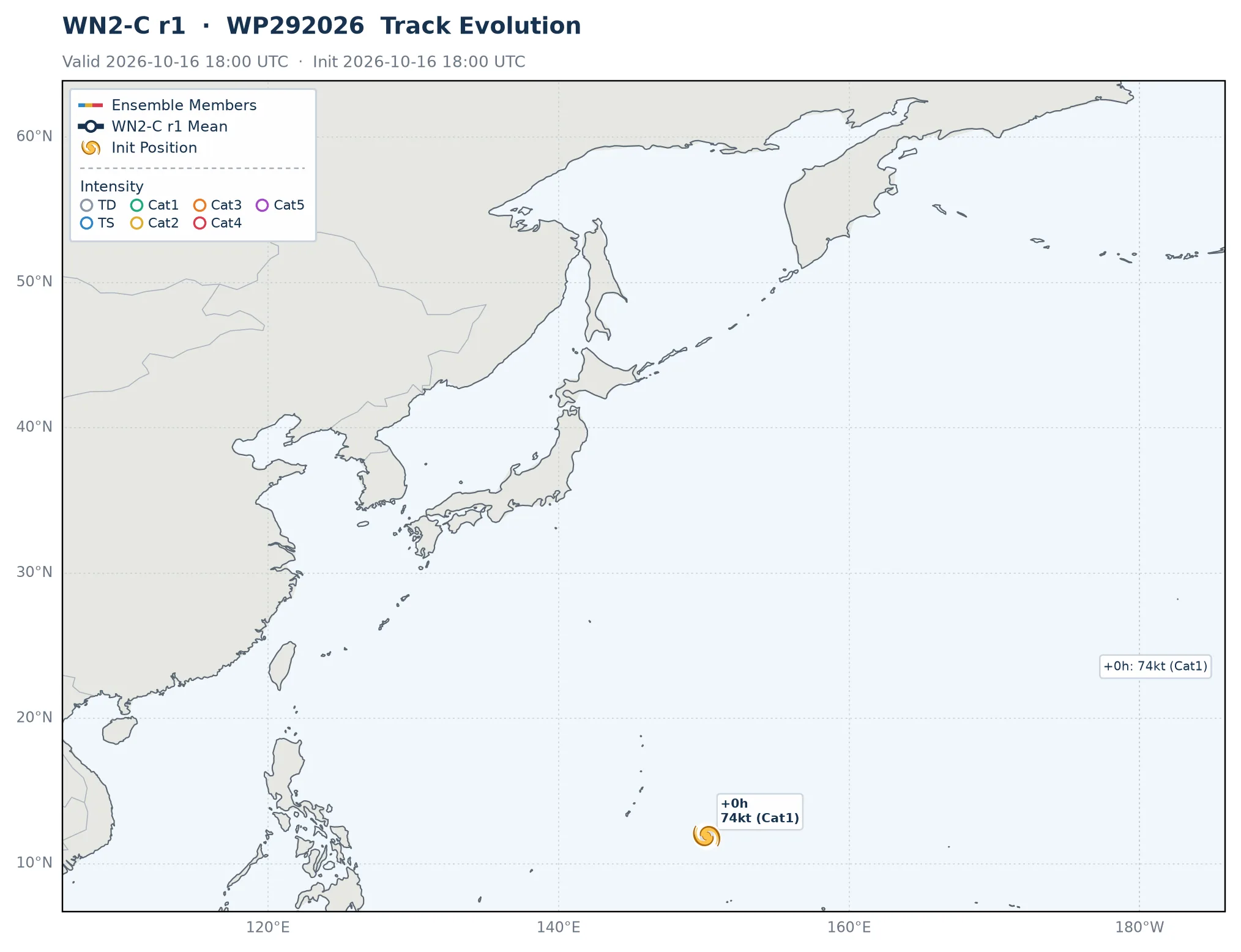
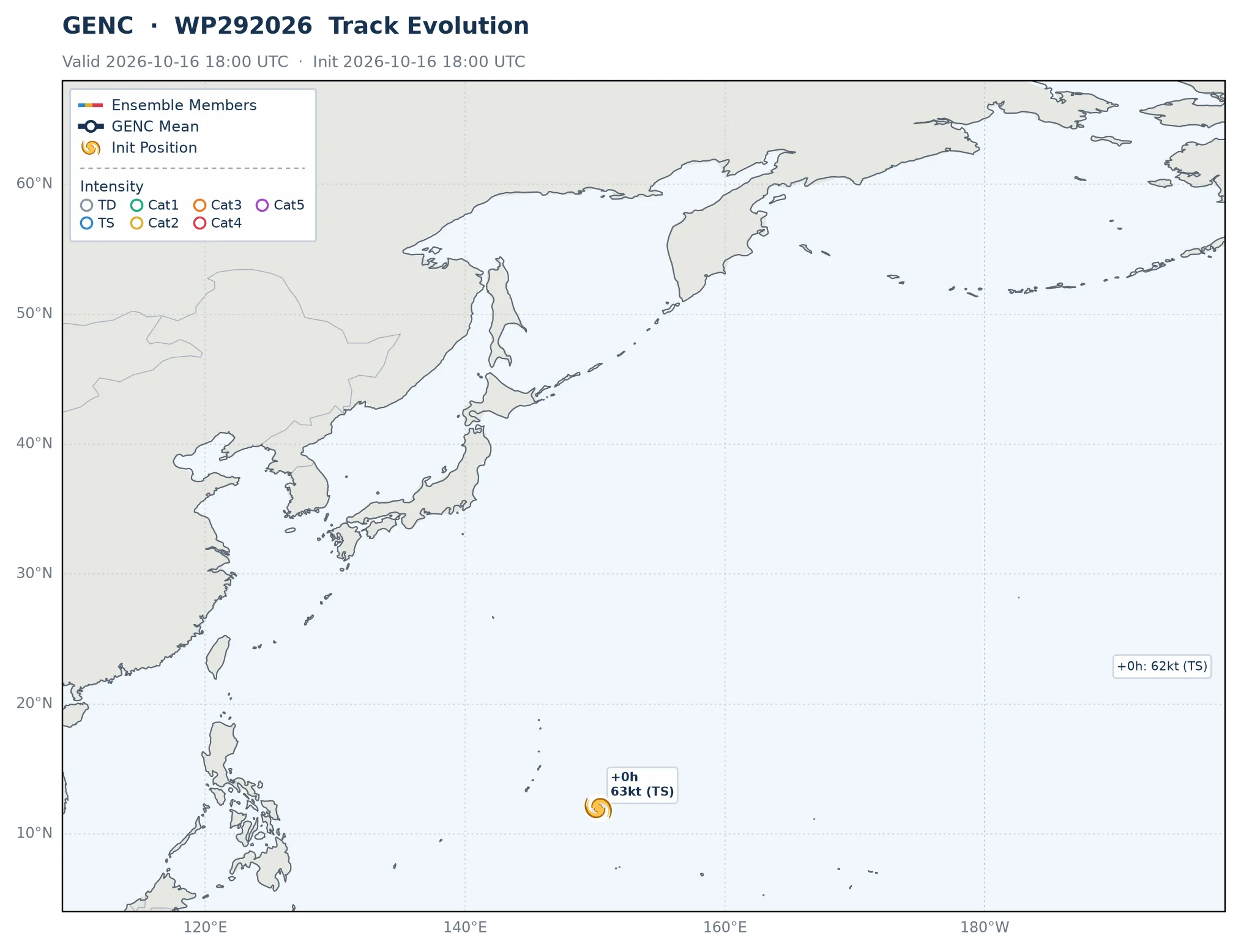
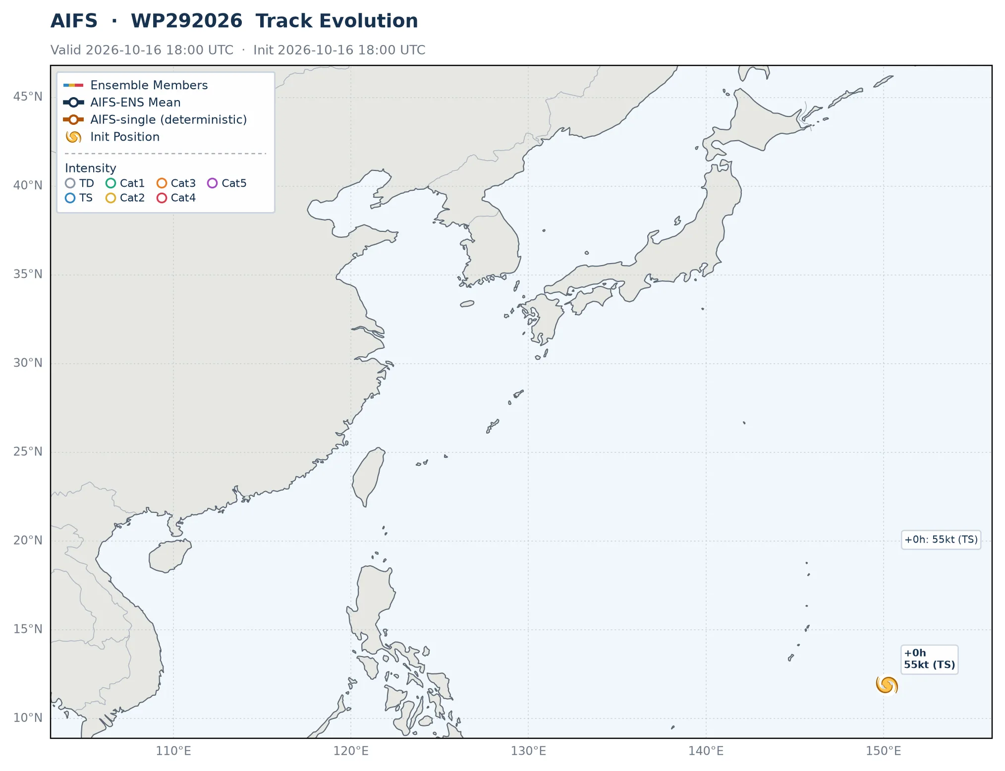
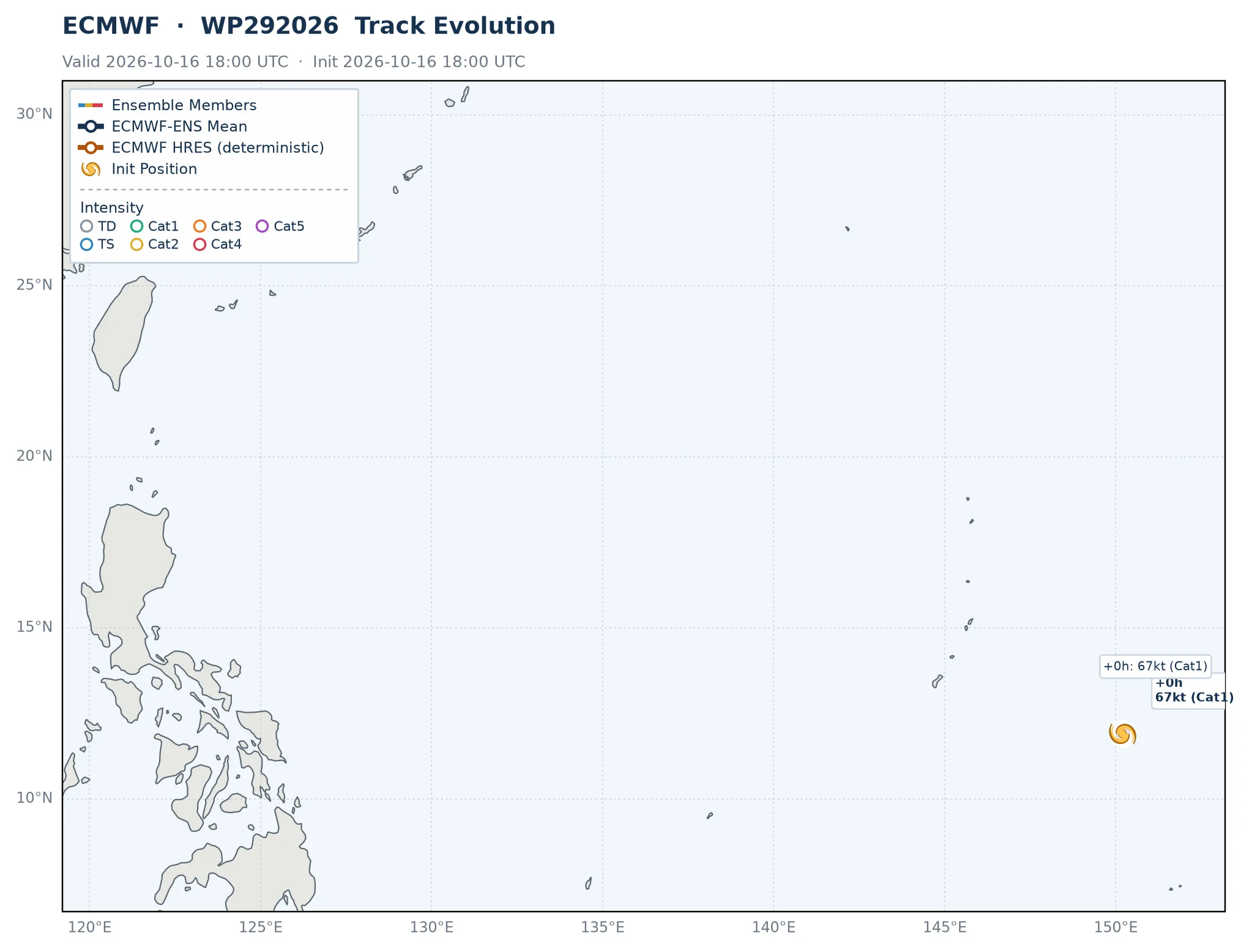
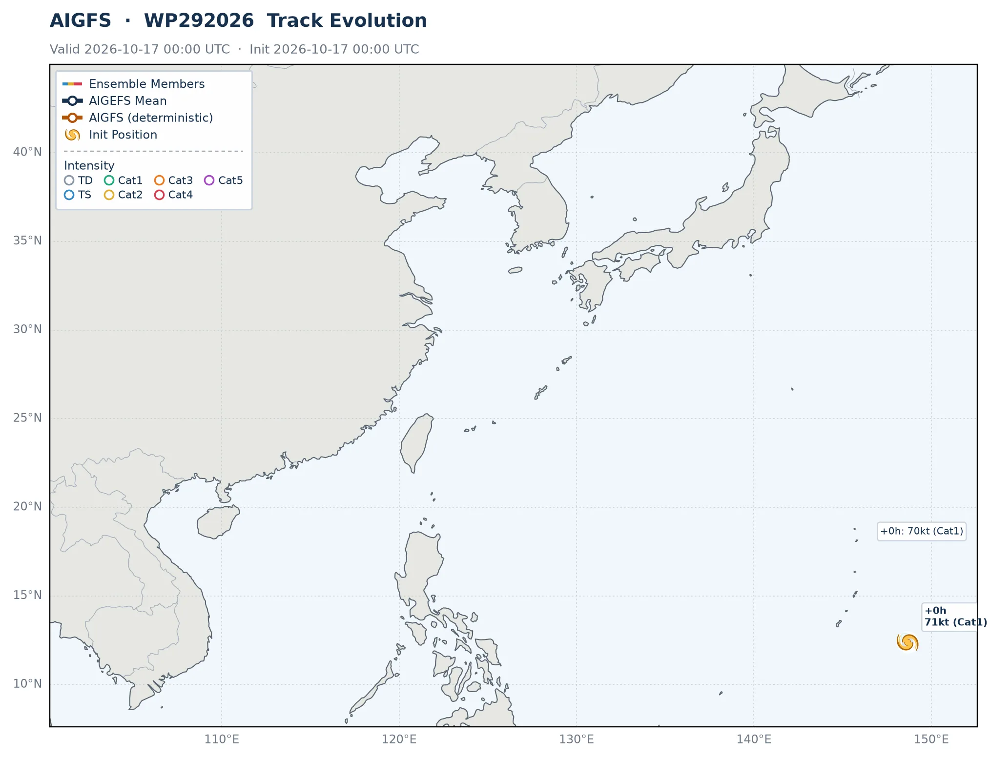
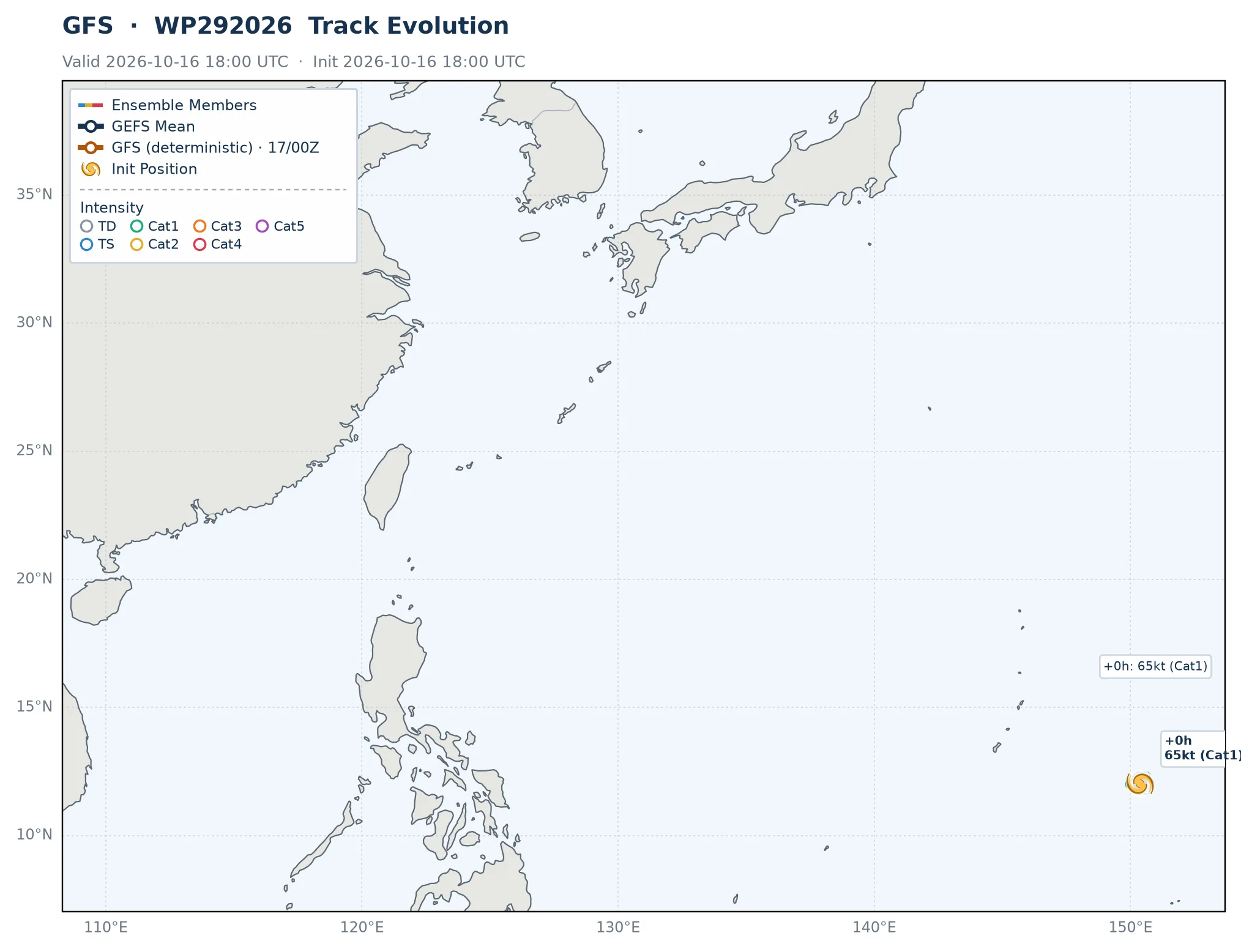
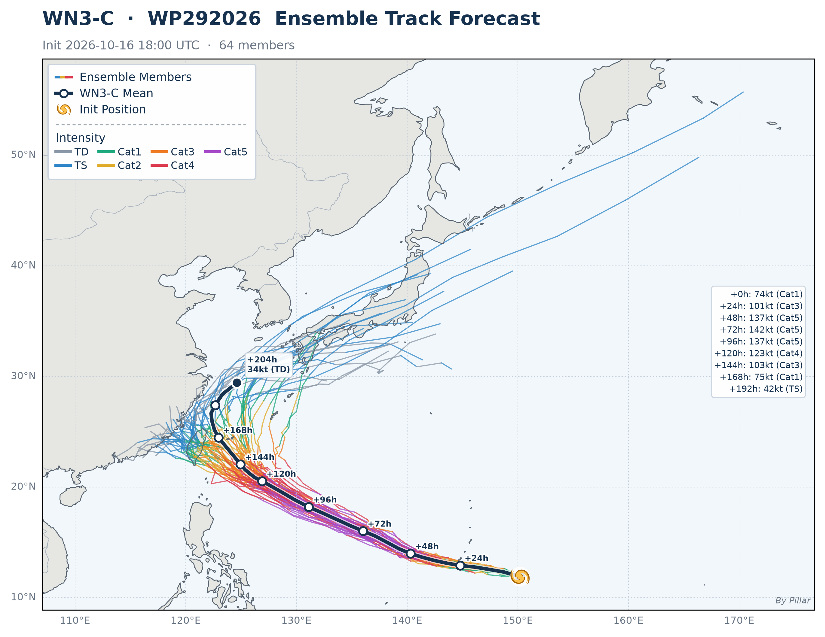 🔍 Click to enlarge
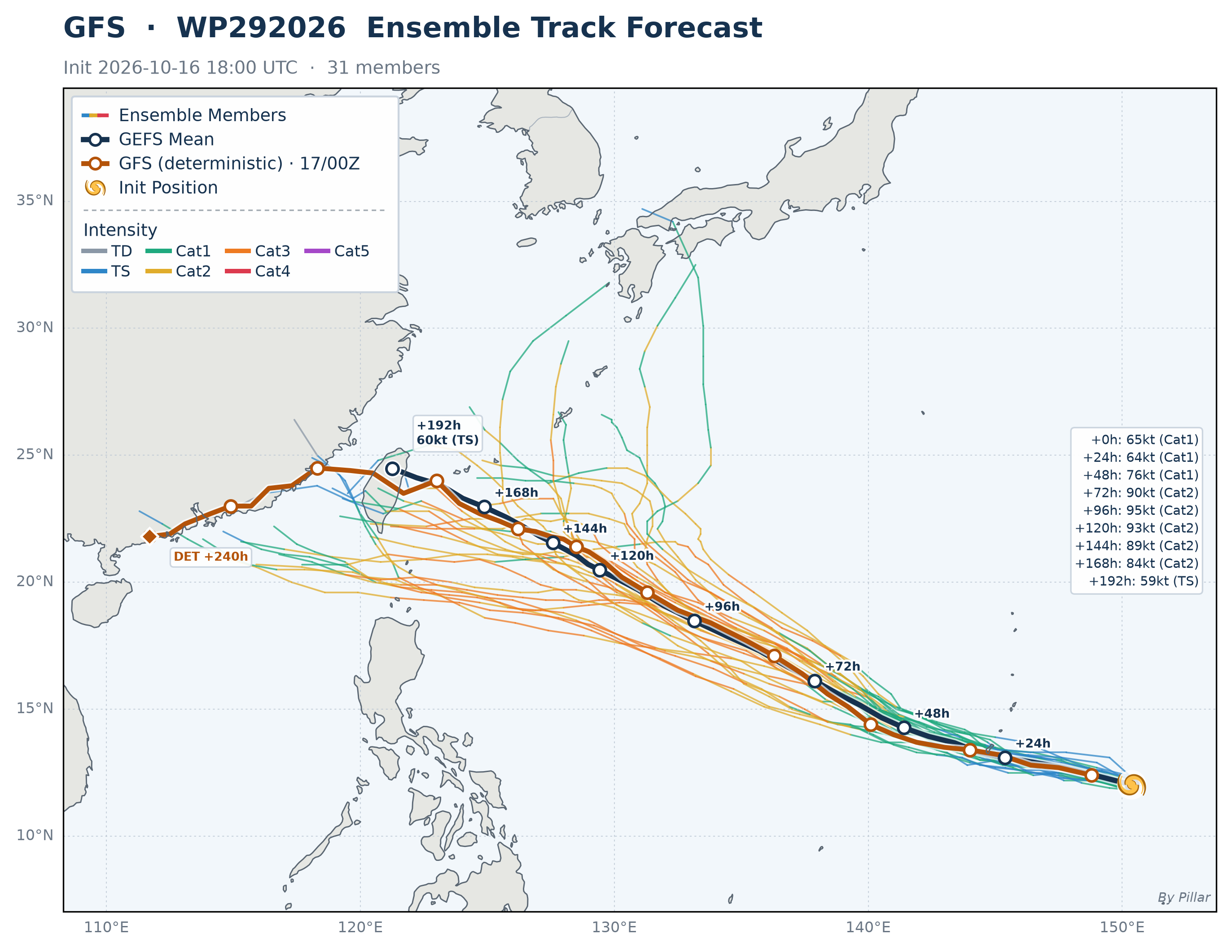
WN3-C · Colored lines = ensemble members (color = intensity) · Navy line = ensemble mean · Cyclone symbol = initial position
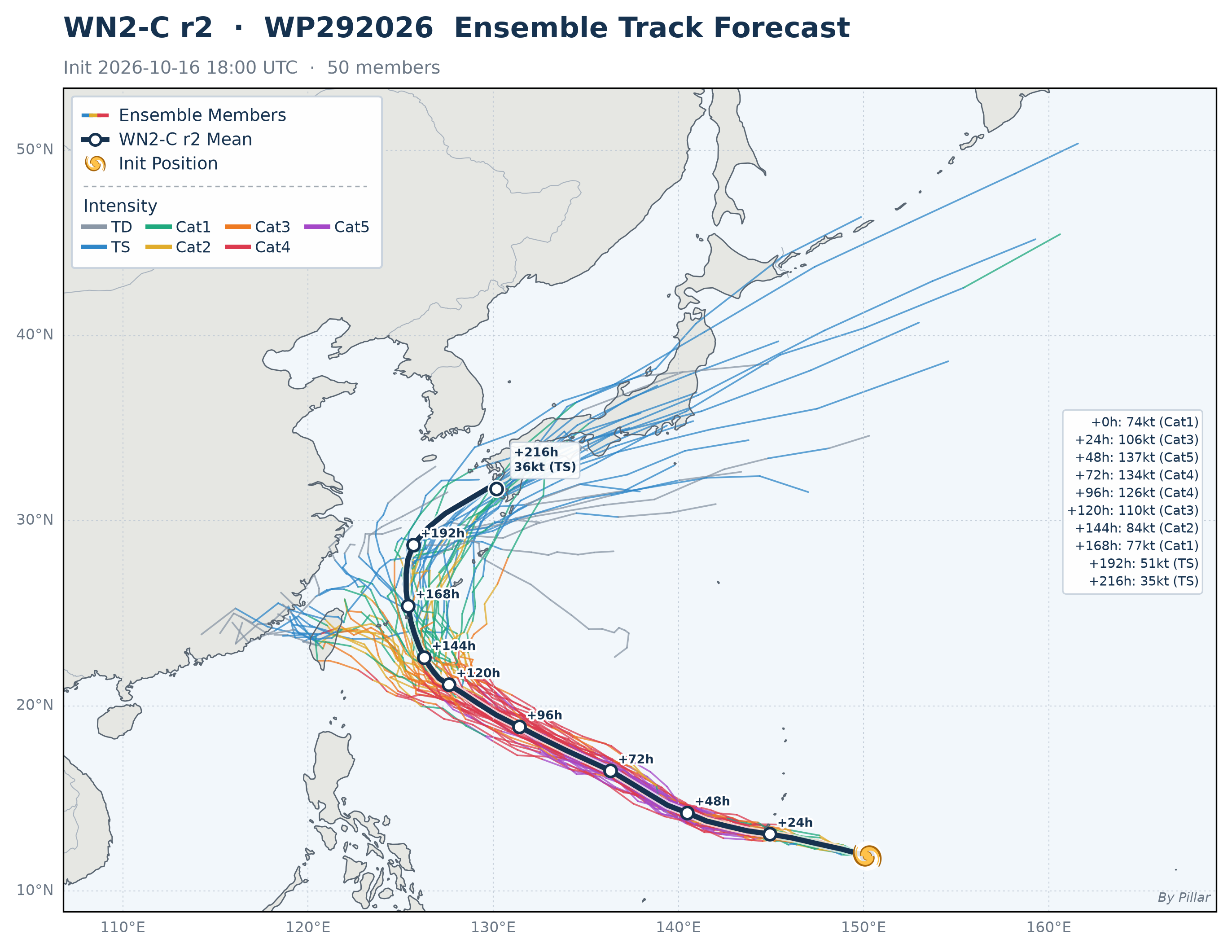
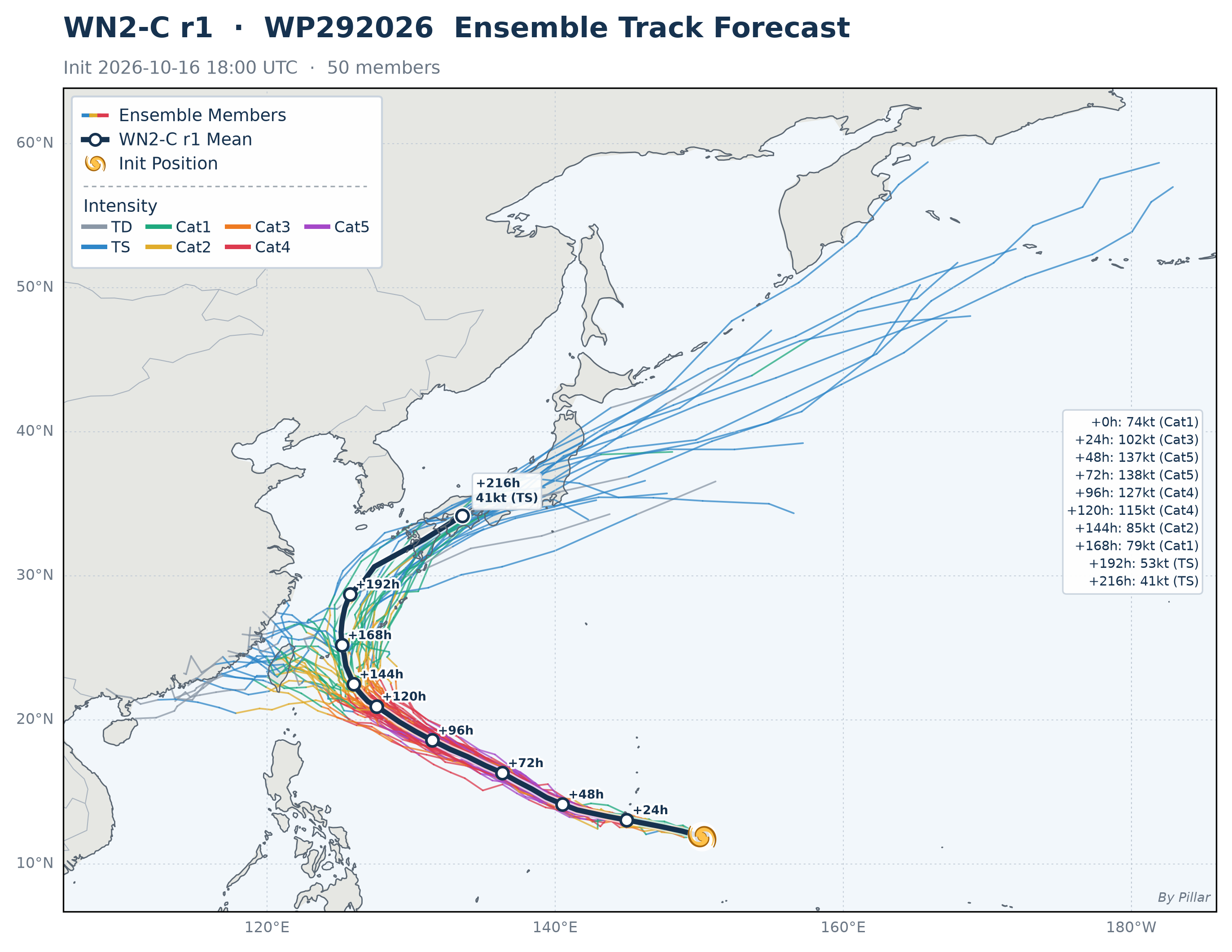
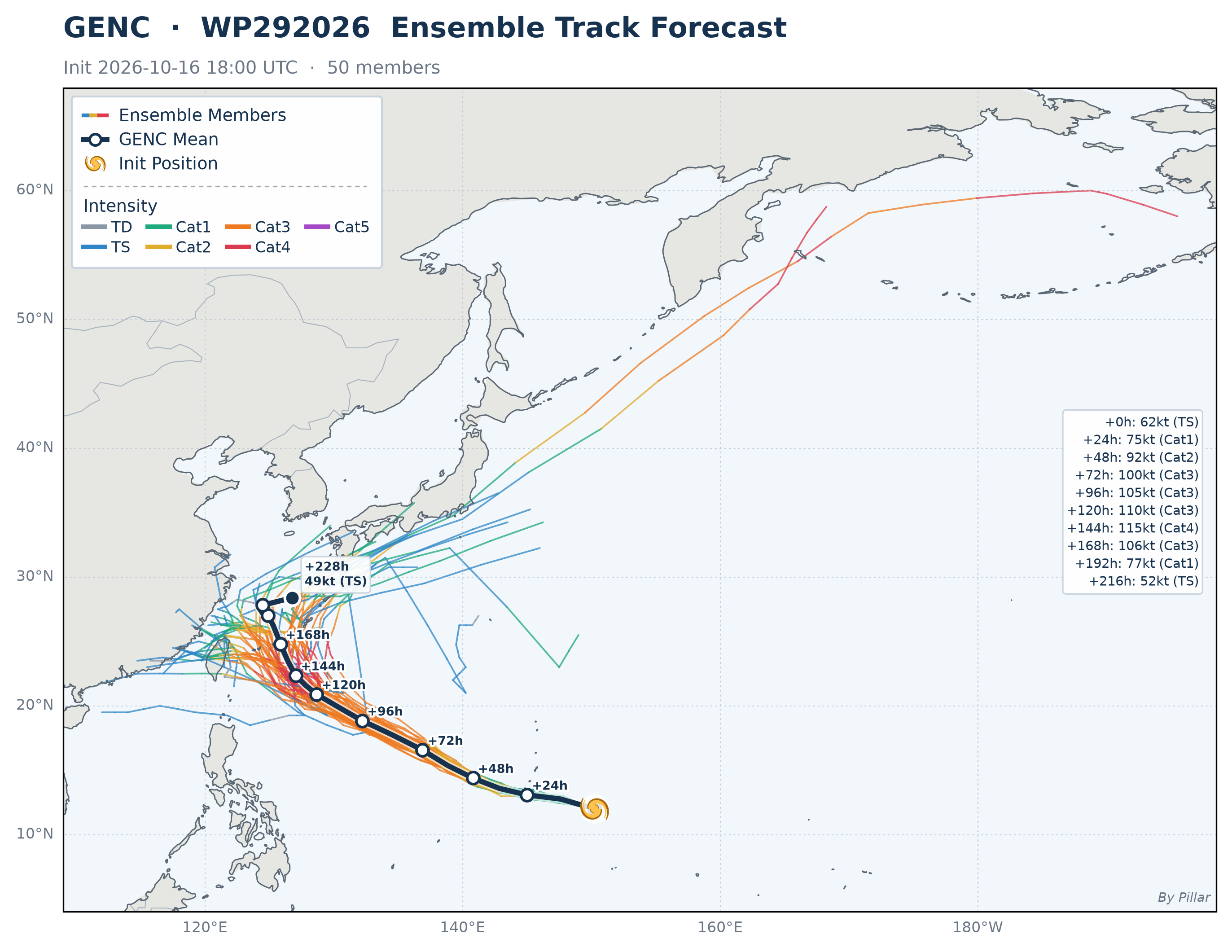
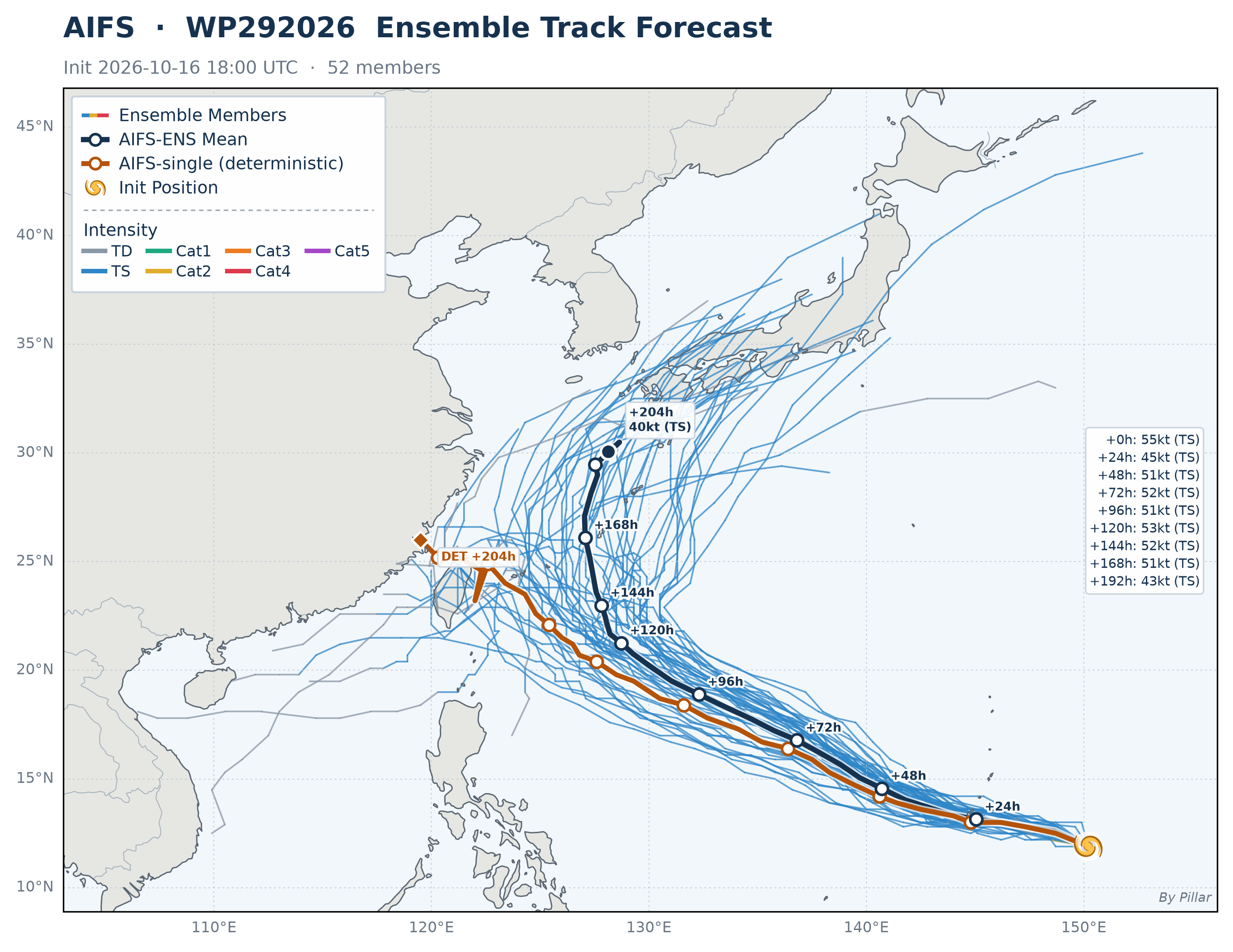
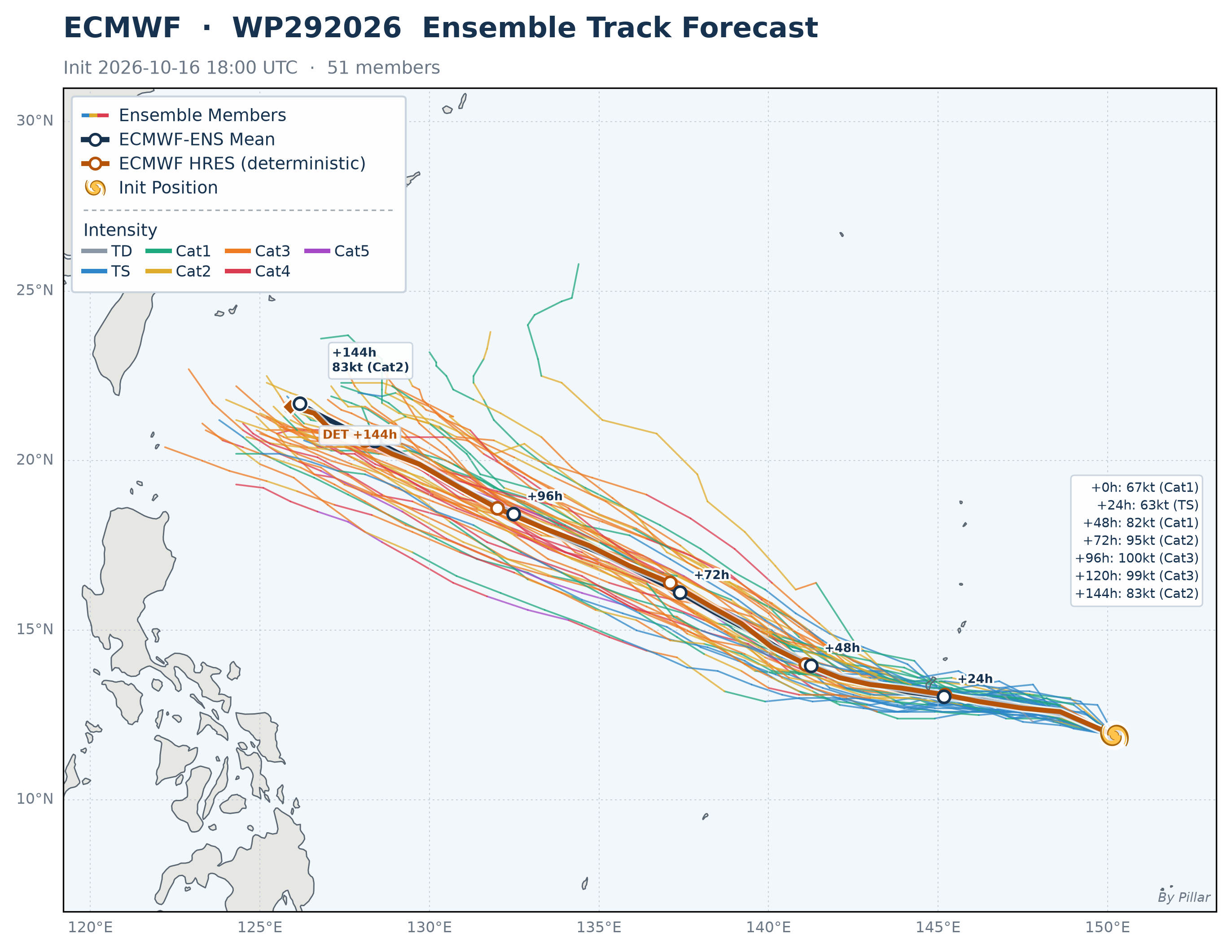
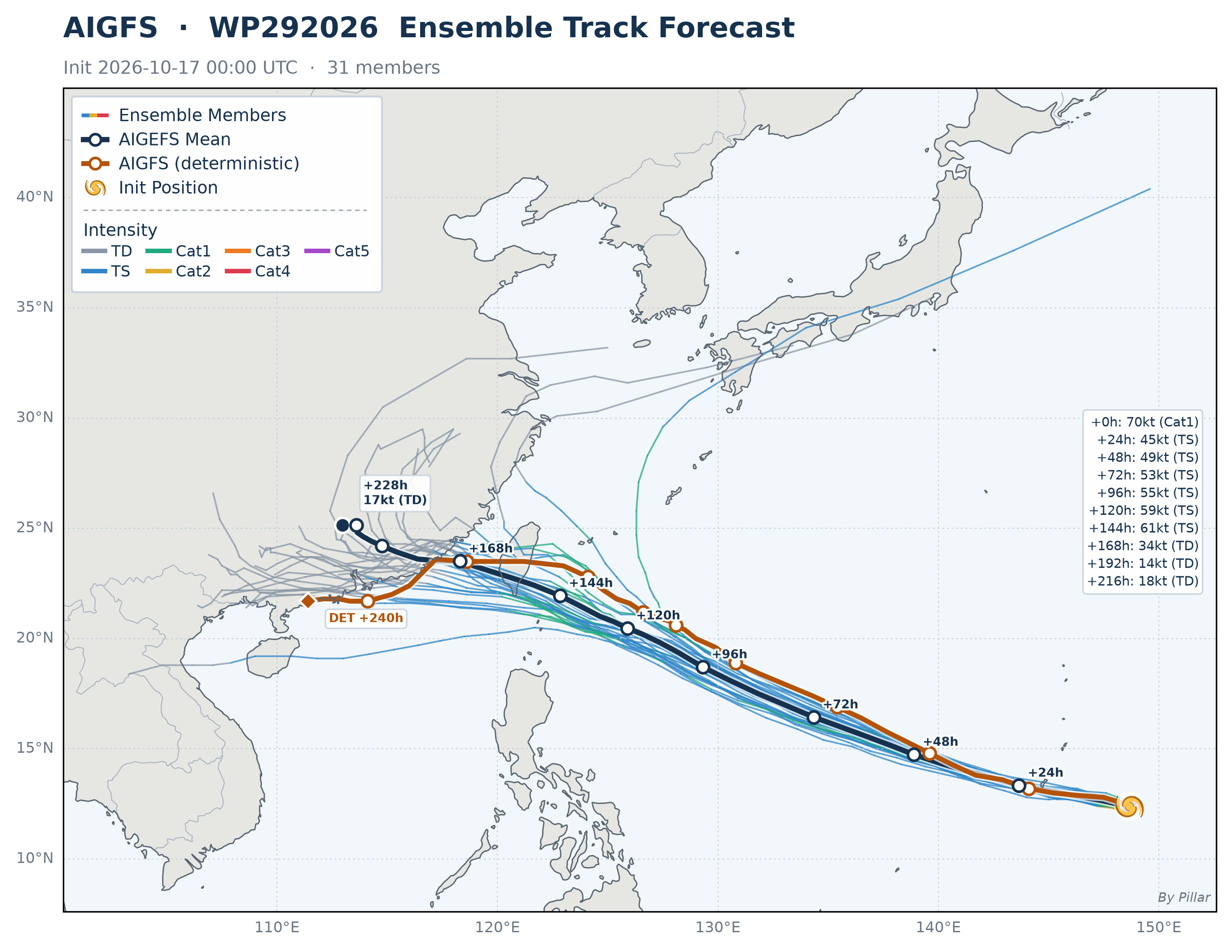
 🔍 Click to enlarge
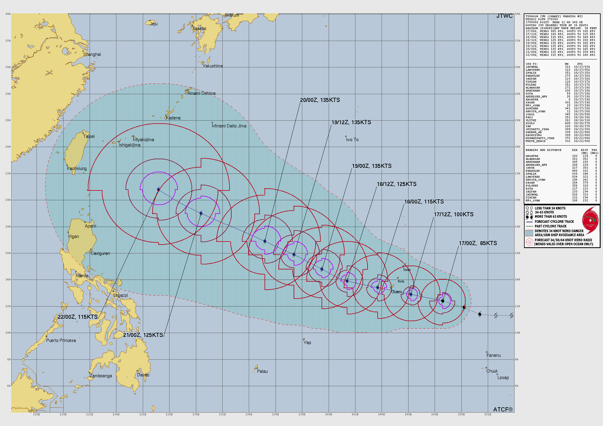
Source: Joint Typhoon Warning Center (JTWC) — U.S. Navy & Air Force
Drag / scroll to zoom · Hover a line for member, time (UTC) and wind · Member colors = intensity
 🔍 Click to enlarge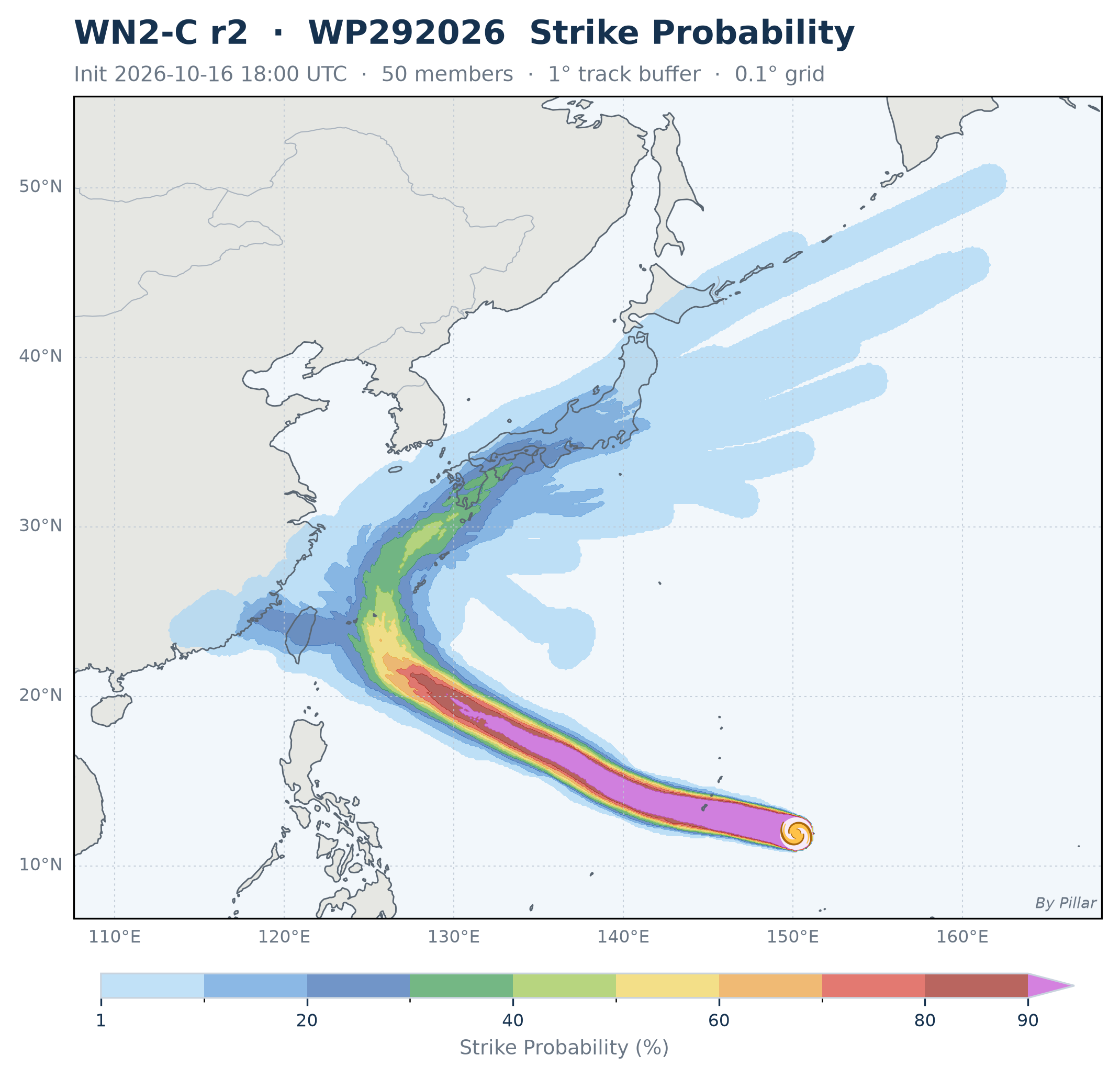
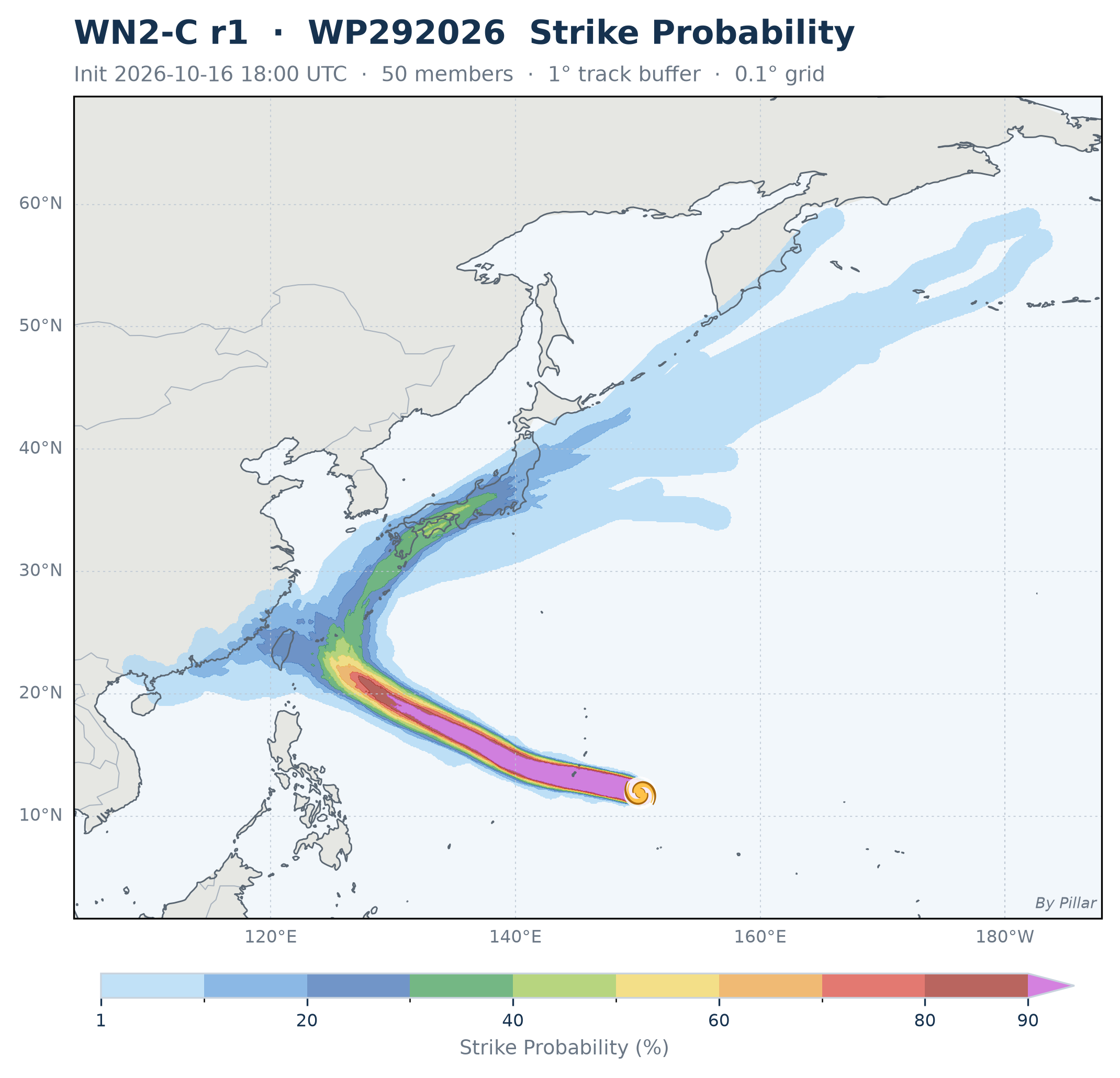
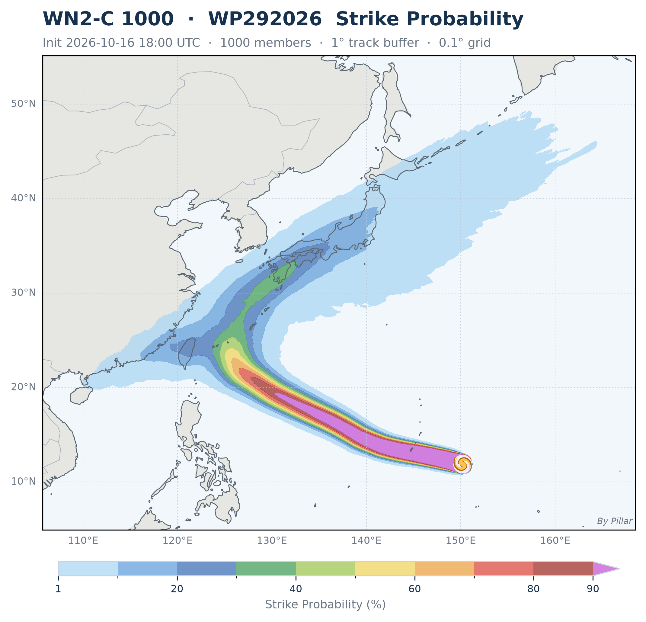
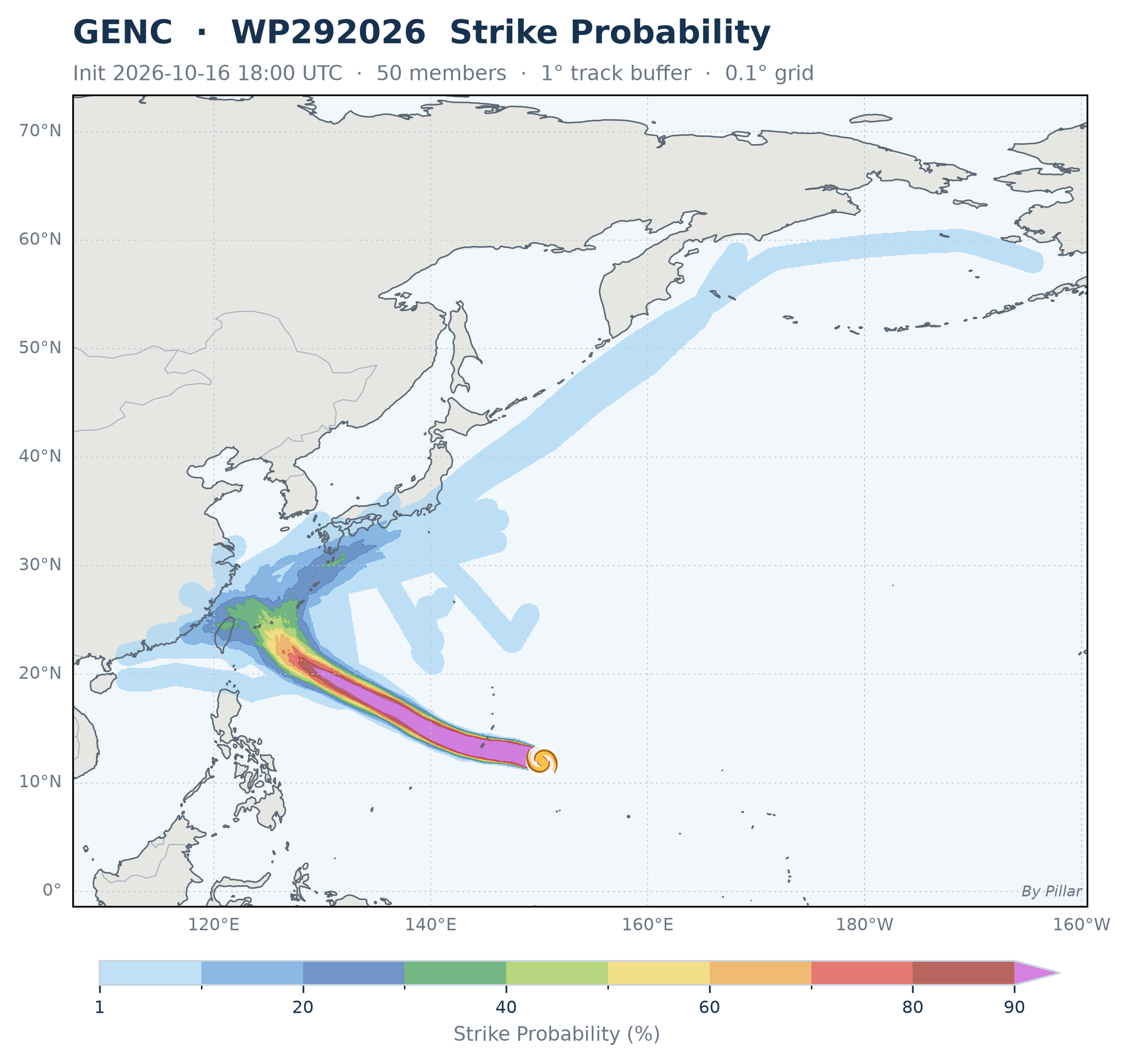
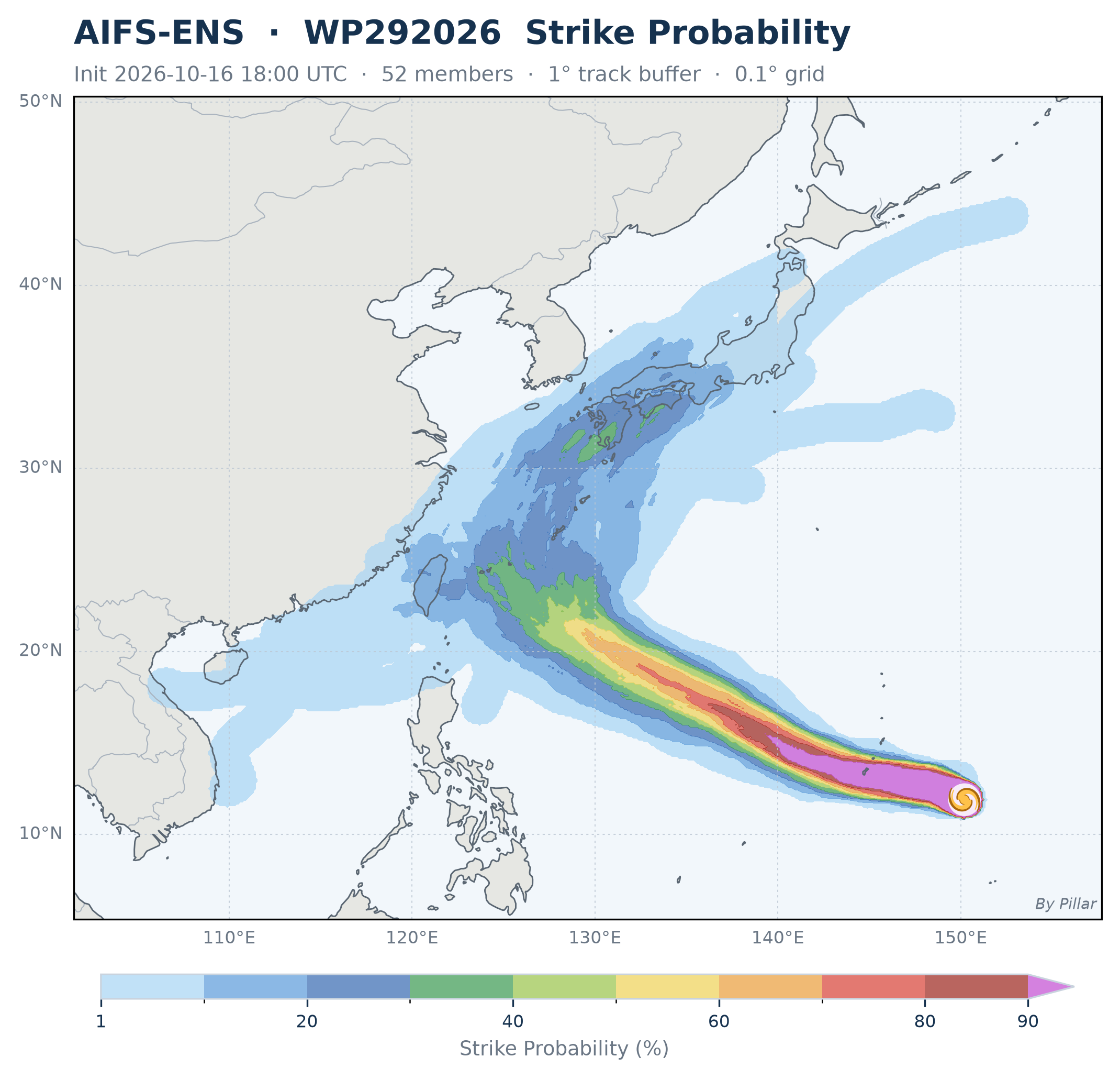
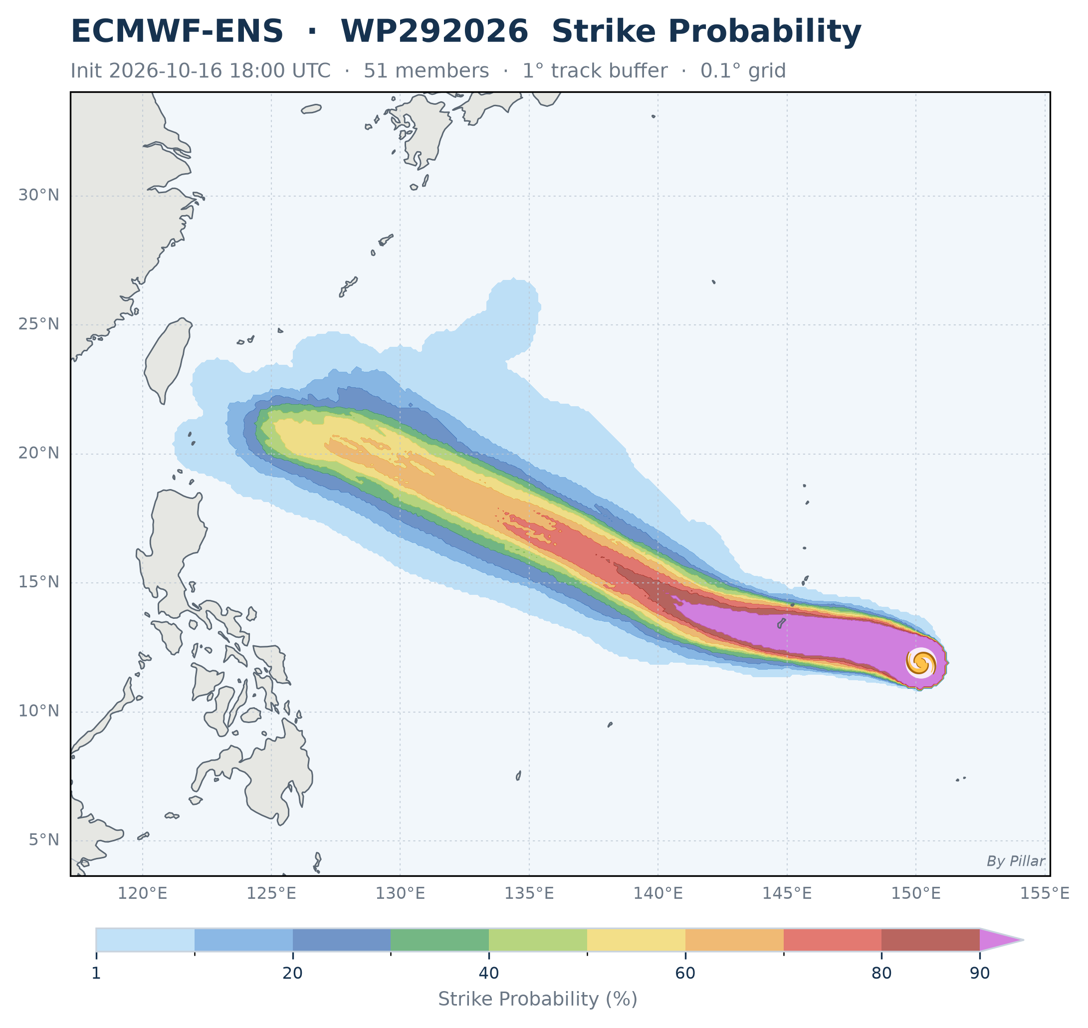
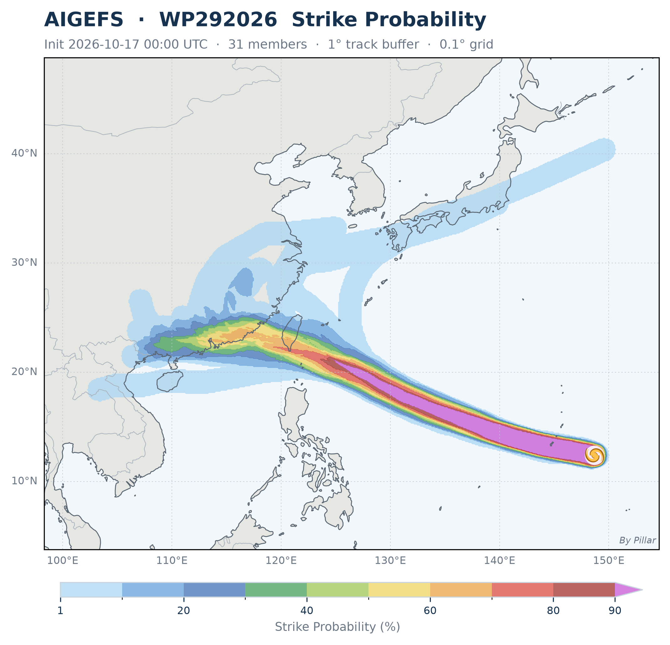
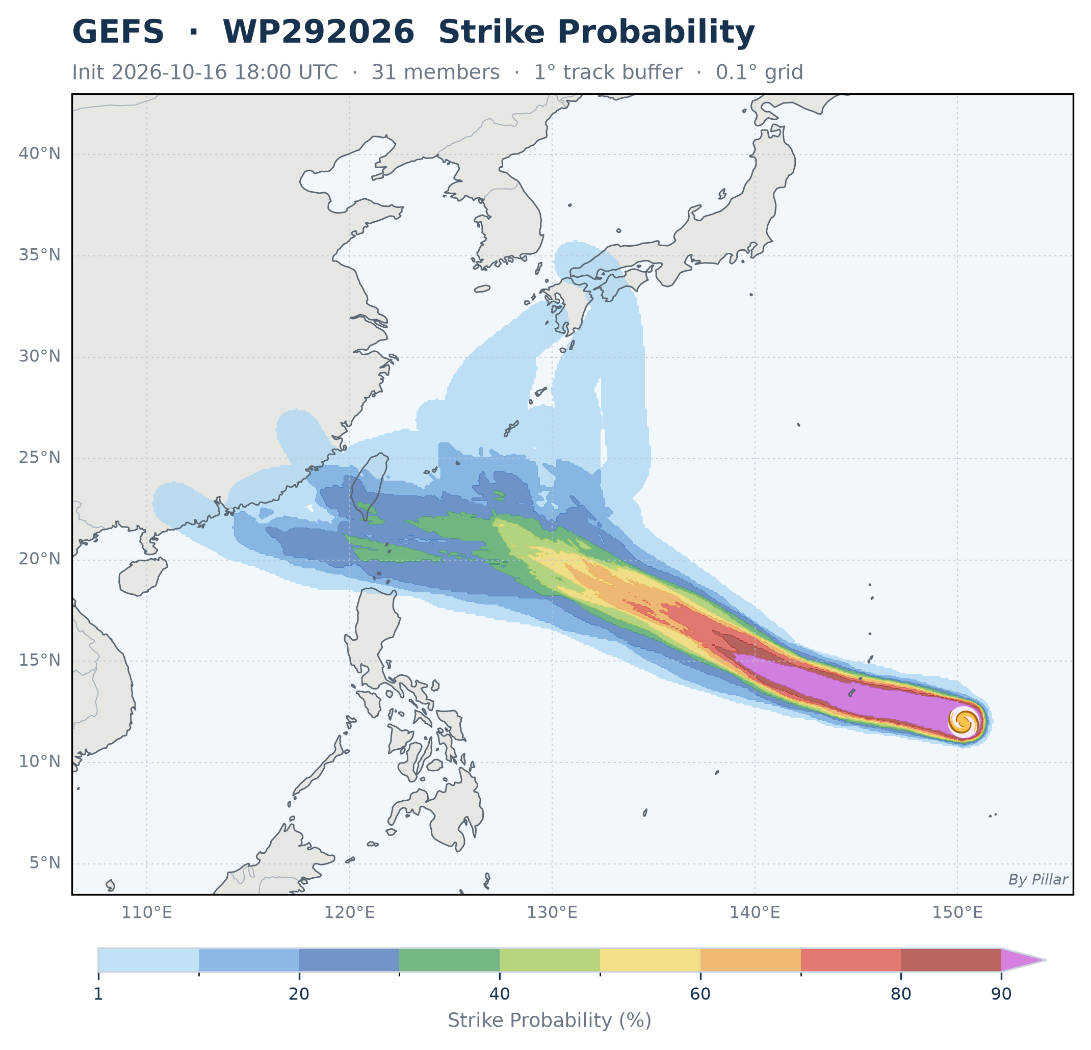
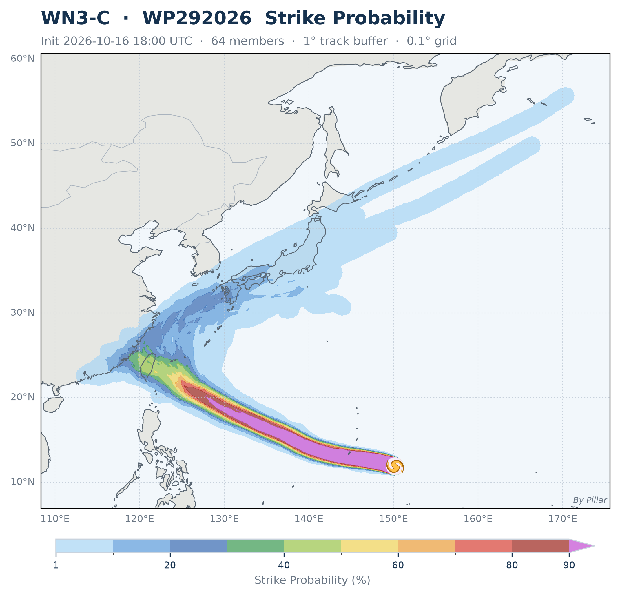
Share of ensemble members whose track passes within 1° (~111 km) of each 0.1° grid point at any time in the forecast · Intensity is not considered
 🔍 Click to enlarge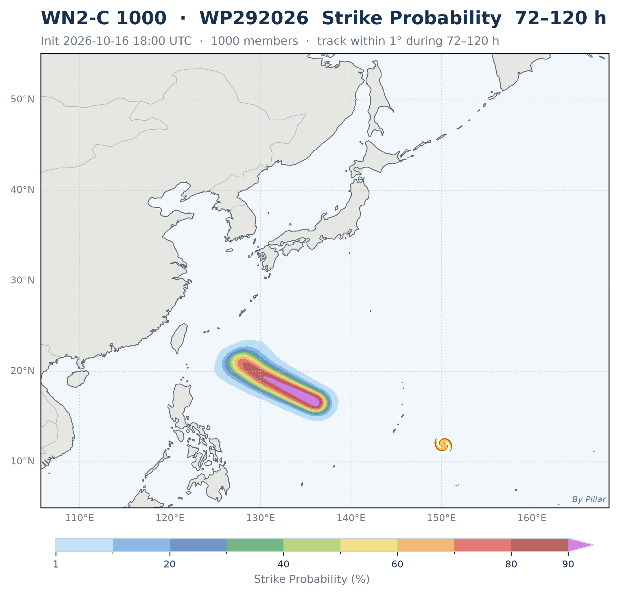
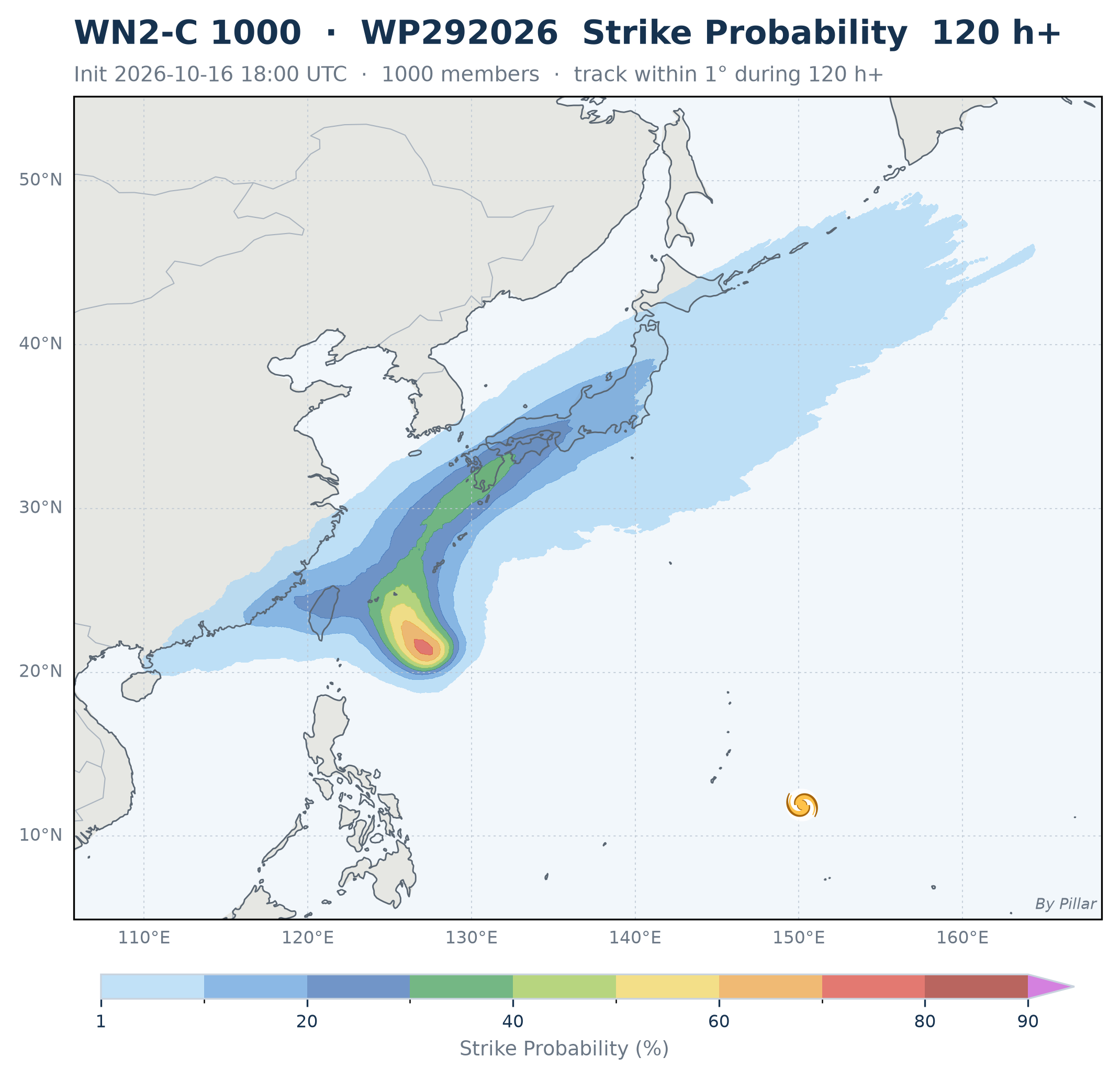
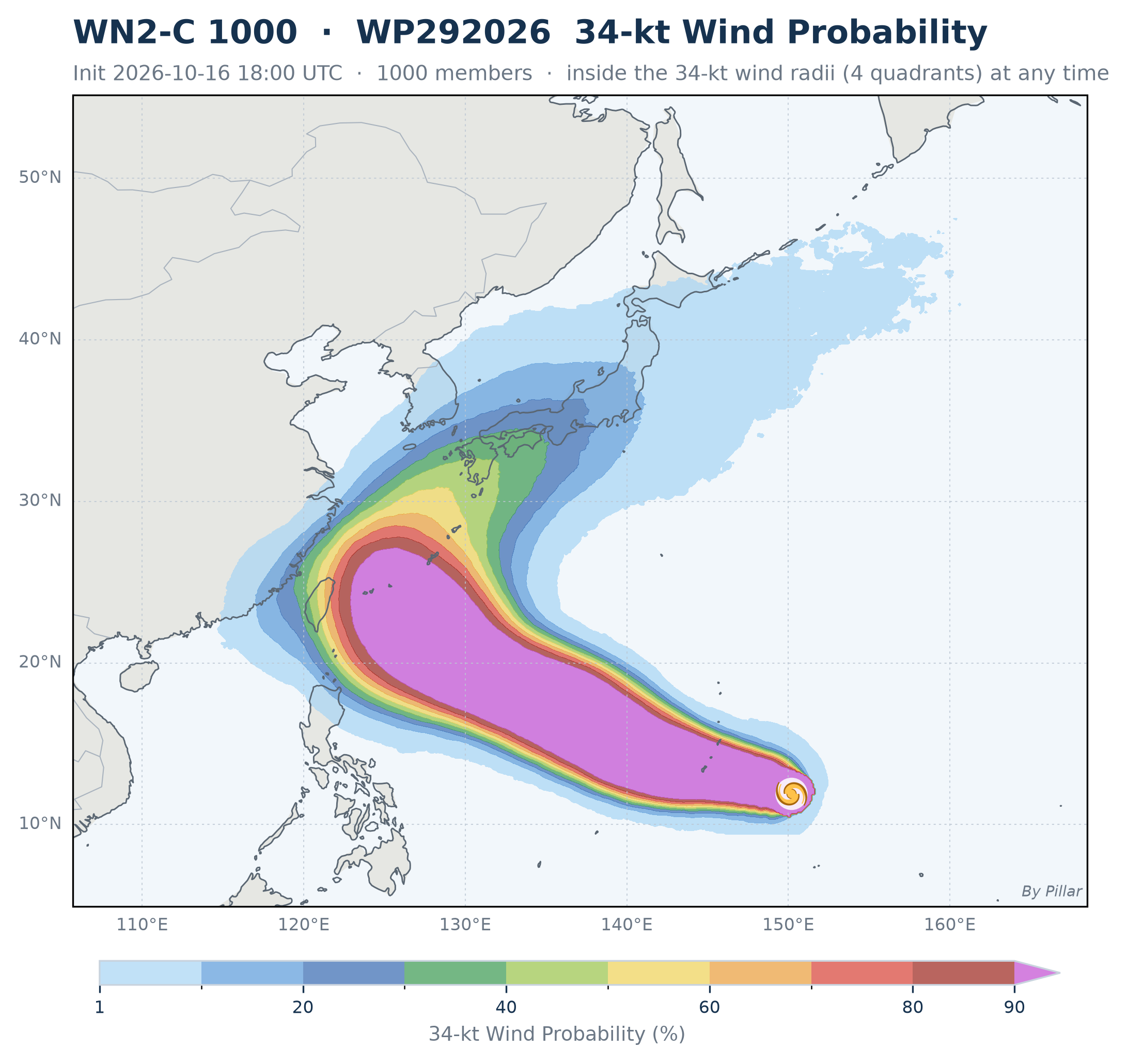
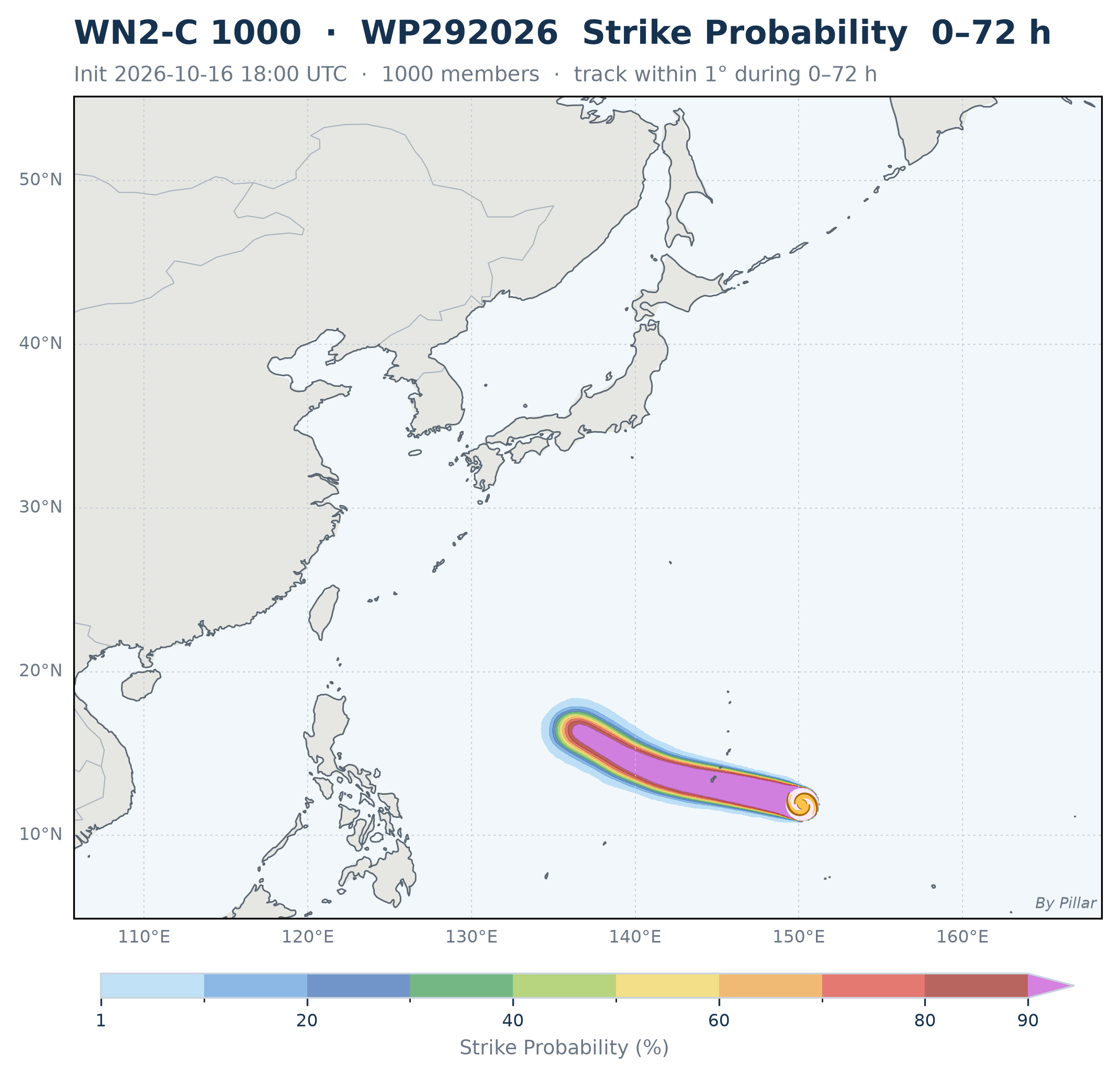
Same 1° rule split into forecast periods · 34 kt = inside the forecast 34-kt wind radii at any time · 1000 members
| Model | WN3-C10/16 18Z · ≤318 h | WN2-C r210/16 18Z · ≤312 h | WN2-C r110/16 18Z · ≤270 h | WN2-C 100010/16 18Z · ≤348 h | GENC10/16 18Z · ≤360 h | AIFS-ENS10/16 18Z · ≤342 h | AIFS-single10/16 18Z · ≤204 h | ECMWF-ENS10/16 18Z · ≤144 h | ECMWF HRES10/16 18Z · ≤144 h | AIGEFS10/16 18Z · ≤240 h | AIGFS10/16 18Z · ≤240 h | GEFS10/16 18Z · ≤192 h | GFS10/16 18Z · ≤240 h |
|---|---|---|---|---|---|---|---|---|---|---|---|---|---|
| Taiwan landfallstorm centre moves onto Taiwan's main island (outlying islands excluded) | |||||||||||||
| tw_landfall | 58%10/23 16Z | 26%10/24 02Z | 34%10/24 00Z | 27%10/24 06Z | 30%10/24 19Z | 17%10/23 18Z | ✓10/24 08Z | <1% | — | 74%10/23 10Z | ✓10/24 11Z | 26%10/24 12Z | ✓10/24 08Z |
| City striketrack passes within 1° (~111 km) of the city | |||||||||||||
| taipei | 30%10/23 21Z | 16%10/23 19Z | 20%10/24 01Z | 21%10/24 07Z | 26%10/24 17Z | 15%10/24 01Z | ✓10/24 04Z | <1% | — | 16%10/24 02Z | — | 6%10/24 10Z | — |
| taichung | 47%10/23 18Z | 26%10/24 06Z | 24%10/24 08Z | 23%10/24 09Z | 28%10/24 20Z | 19%10/24 11Z | — | <1% | — | 42%10/23 15Z | ✓10/24 12Z | 10%10/24 10Z | ✓10/24 08Z |
| kaohsiung | 27%10/23 13Z | 14%10/24 14Z | 16%10/24 07Z | 12%10/24 09Z | 8%10/25 00Z | 14%10/25 00Z | — | <1% | — | 52%10/23 08Z | ✓10/24 13Z | 29%10/24 10Z | — |
| hualien | 39%10/23 12Z | 24%10/23 22Z | 28%10/23 22Z | 23%10/24 02Z | 28%10/24 14Z | 15%10/23 16Z | ✓10/23 19Z | <1% | — | 39%10/23 11Z | ✓10/24 08Z | 10%10/24 08Z | ✓10/24 06Z |
| hengchun | 19%10/23 08Z | 2%10/23 11Z | 10%10/24 02Z | 6%10/24 09Z | 4%10/25 15Z | 12%10/24 15Z | — | <1% | — | 42%10/23 05Z | — | 29%10/24 10Z | — |
| naha | 3%10/23 23Z | 18%10/23 11Z | 26%10/23 08Z | 23%10/23 13Z | 32%10/23 19Z | 21%10/23 15Z | — | <1% | — | 3%10/23 08Z | — | 6%10/23 21Z | — |
| hongkong | 3%10/25 19Z | <1% | 16%10/25 11Z | 5%10/25 17Z | 2%10/25 04Z | 2%10/26 08Z | — | <1% | — | 36%10/25 10Z | ✓10/25 16Z | 10%10/24 14Z | ✓10/25 18Z |
| xiamen | 27%10/24 13Z | 18%10/25 01Z | 18%10/25 00Z | 15%10/24 23Z | 14%10/25 09Z | 4%10/24 14Z | — | <1% | — | 58%10/24 04Z | — | 10%10/24 06Z | ✓10/24 20Z |
| shanghai | <1% | <1% | <1% | <1% | 2%10/25 16Z | <1% | — | <1% | — | <1% | — | <1% | — |
| tokyo | 5%10/25 22Z | 14%10/25 09Z | 22%10/25 10Z | 11%10/25 12Z | 4%10/26 03Z | 8%10/25 08Z | — | <1% | — | <1% | — | <1% | — |
| guam | 100%10/17 14Z | 100%10/17 14Z | 100%10/17 14Z | 100%10/17 14Z | 100%10/17 14Z | 100%10/17 14Z | ✓10/17 14Z | 98%10/17 15Z | ✓10/17 15Z | 100%10/17 15Z | ✓10/17 16Z | 100%10/17 16Z | ✓10/17 15Z |
Share of members whose track passes within 1° (~111 km) of the city · Time below = median first arrival among those members (UTC) · Taiwan cities always shown; others only when any model reaches 1%
 🔍 Click to enlarge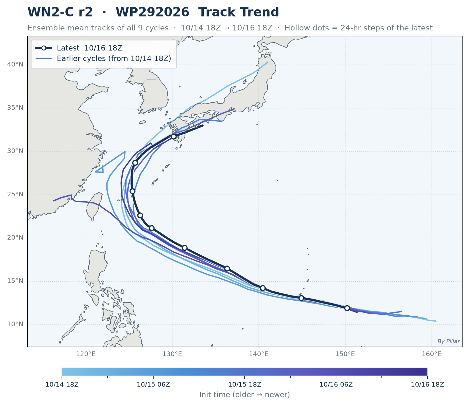
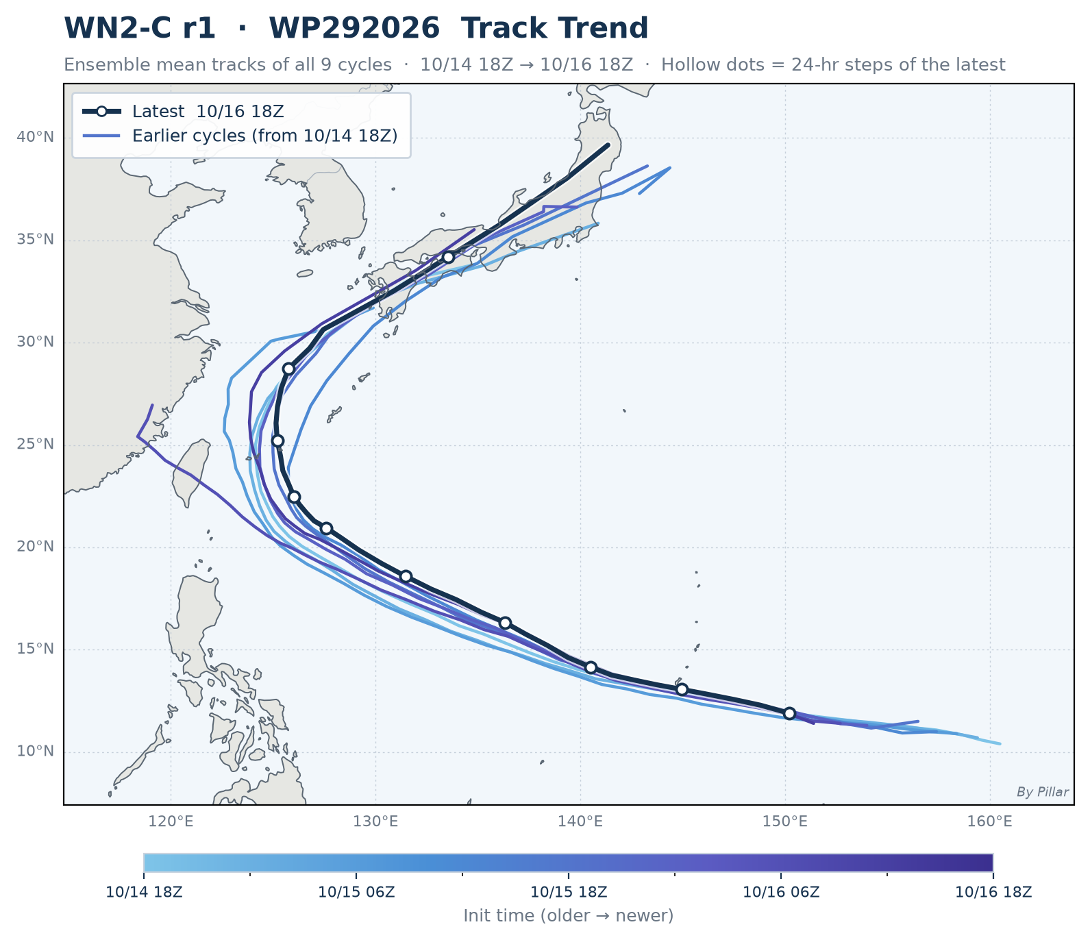
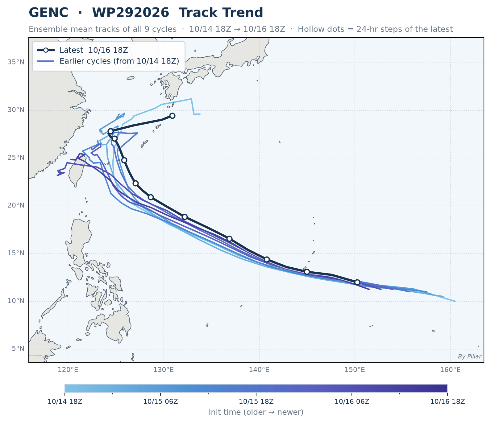
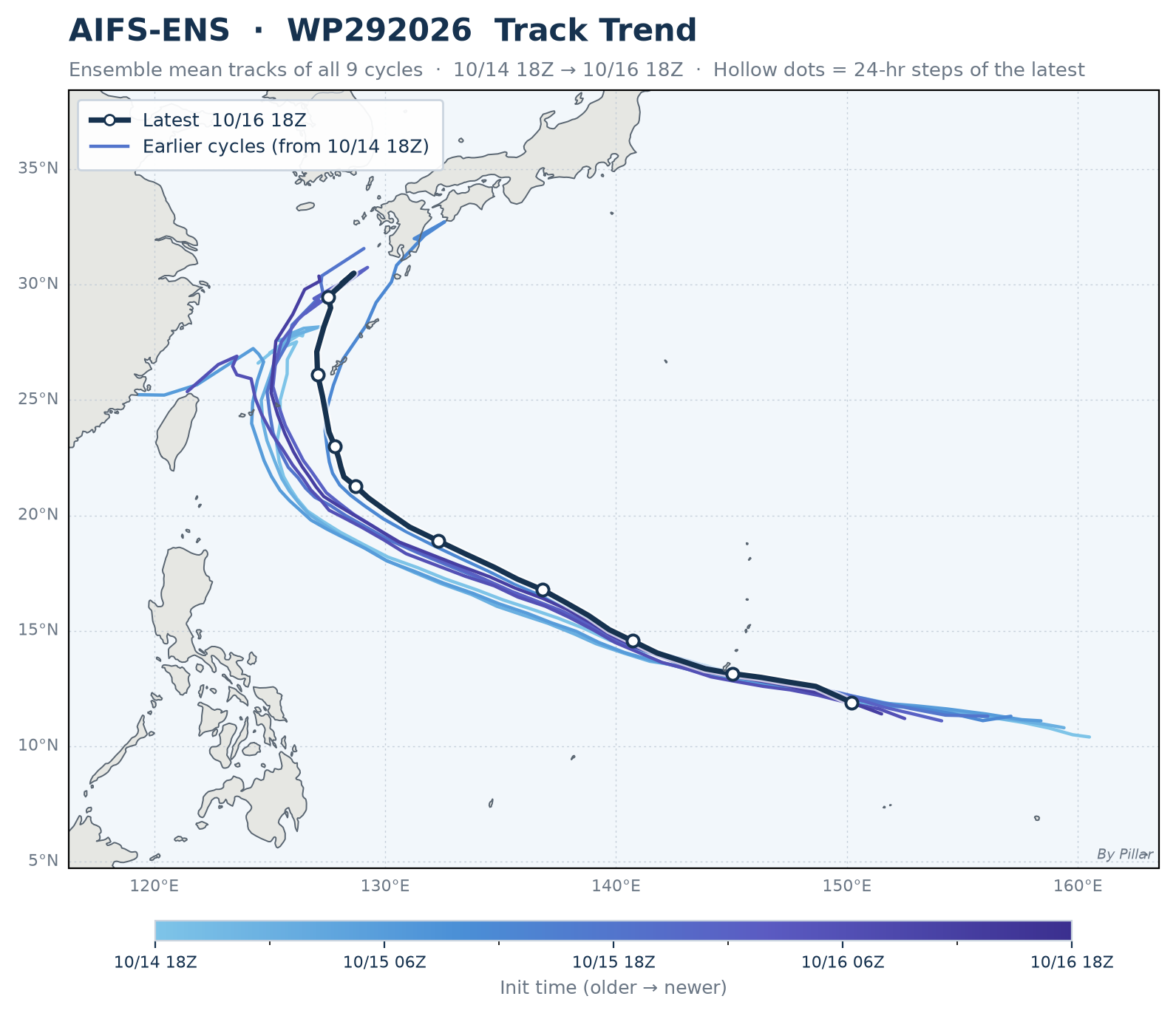
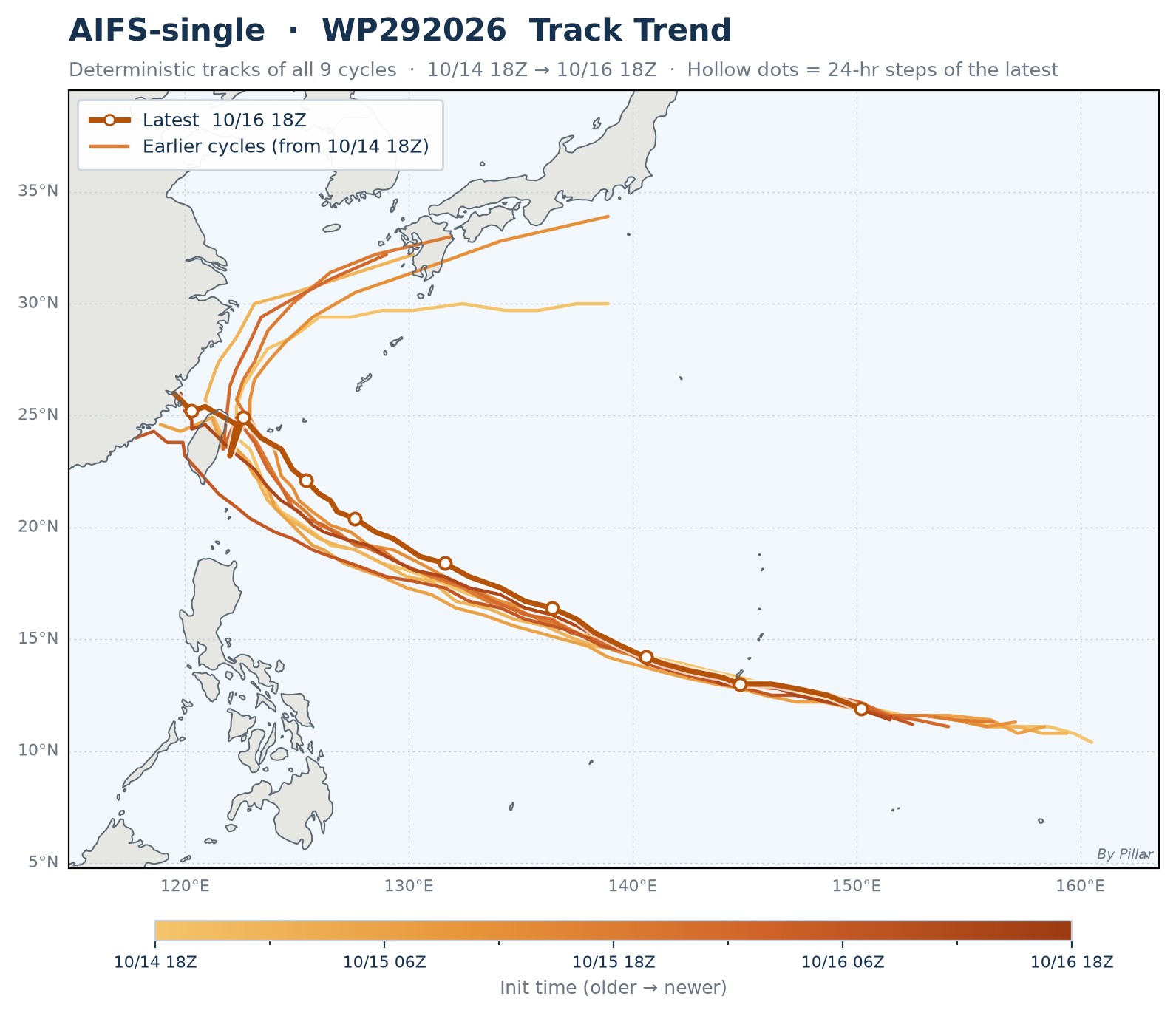
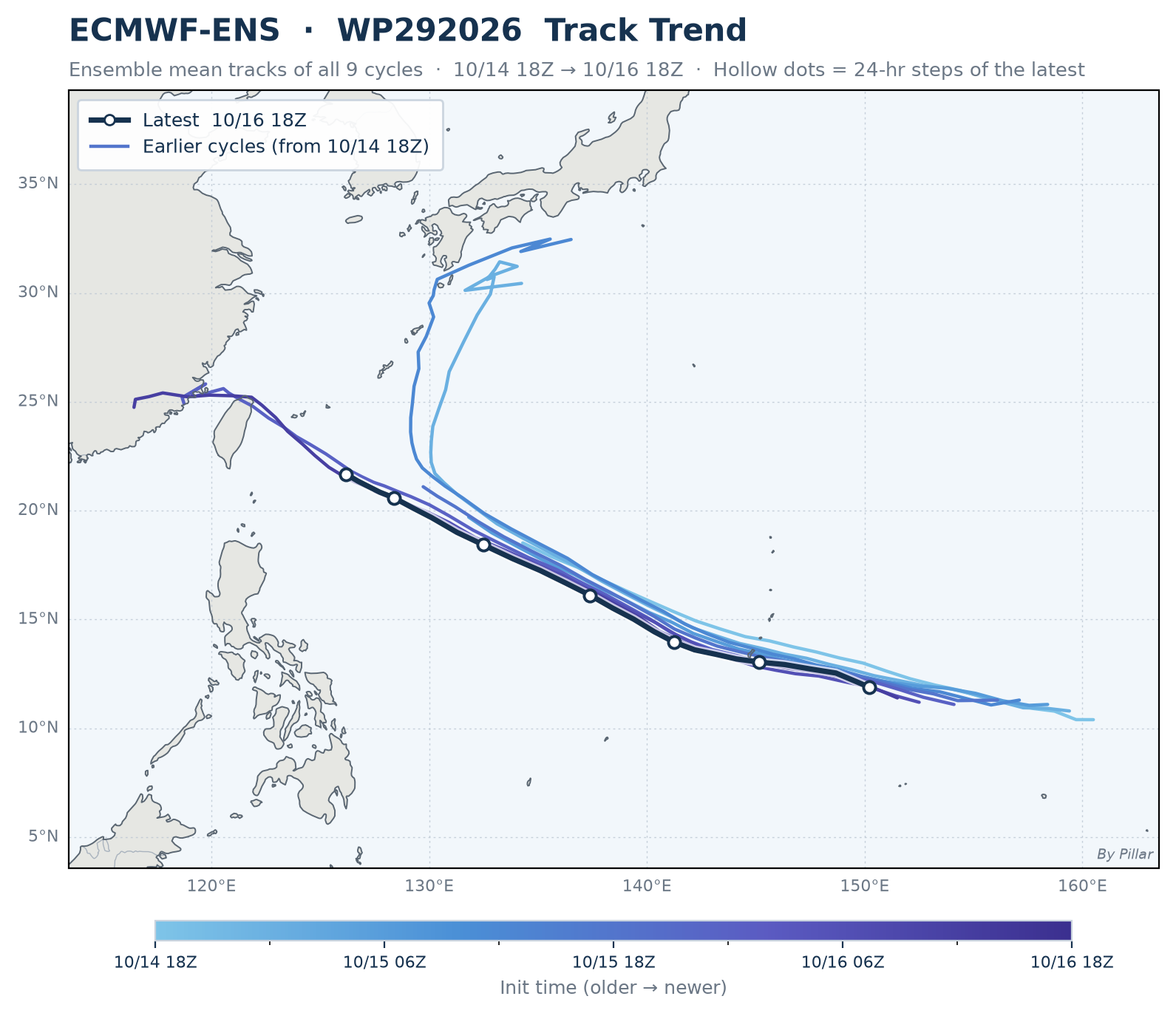
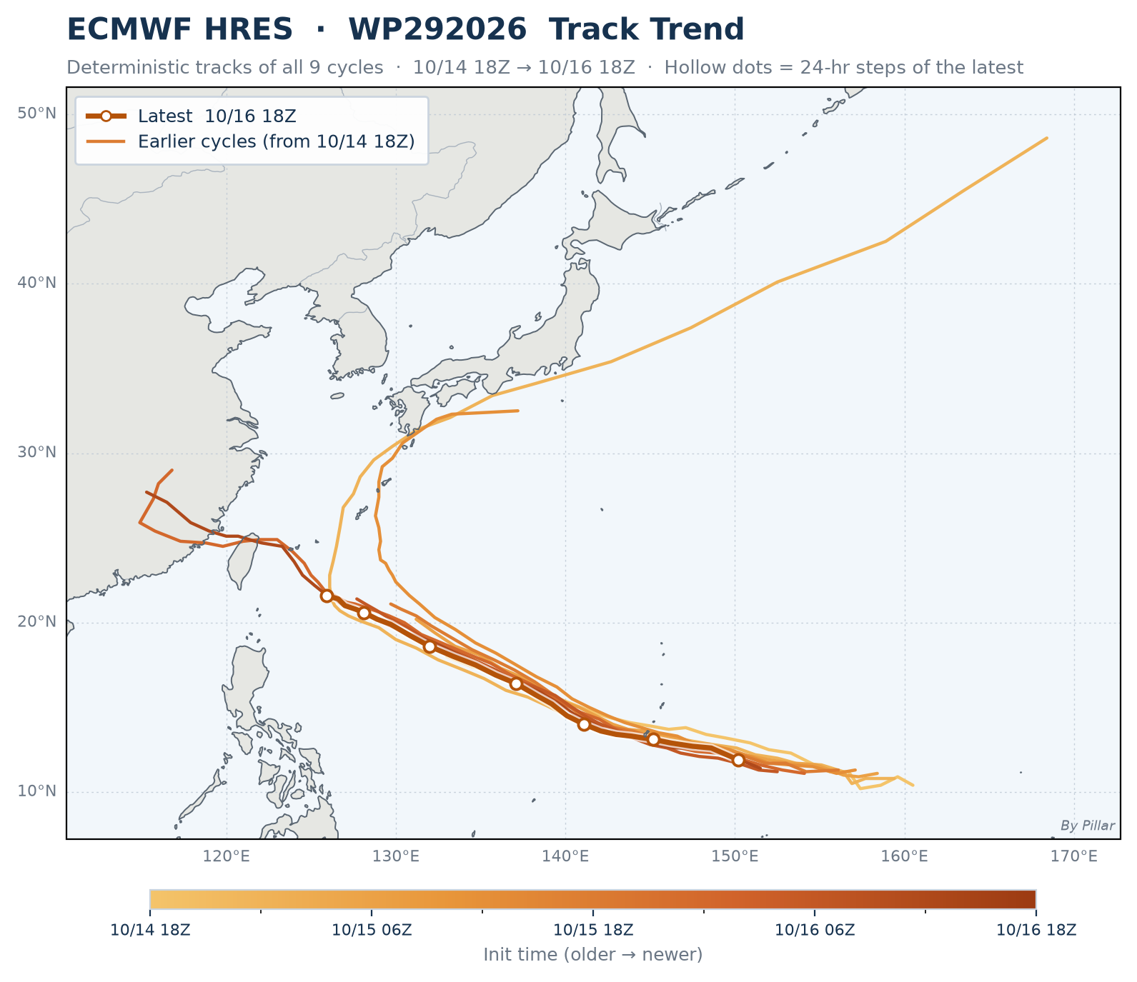
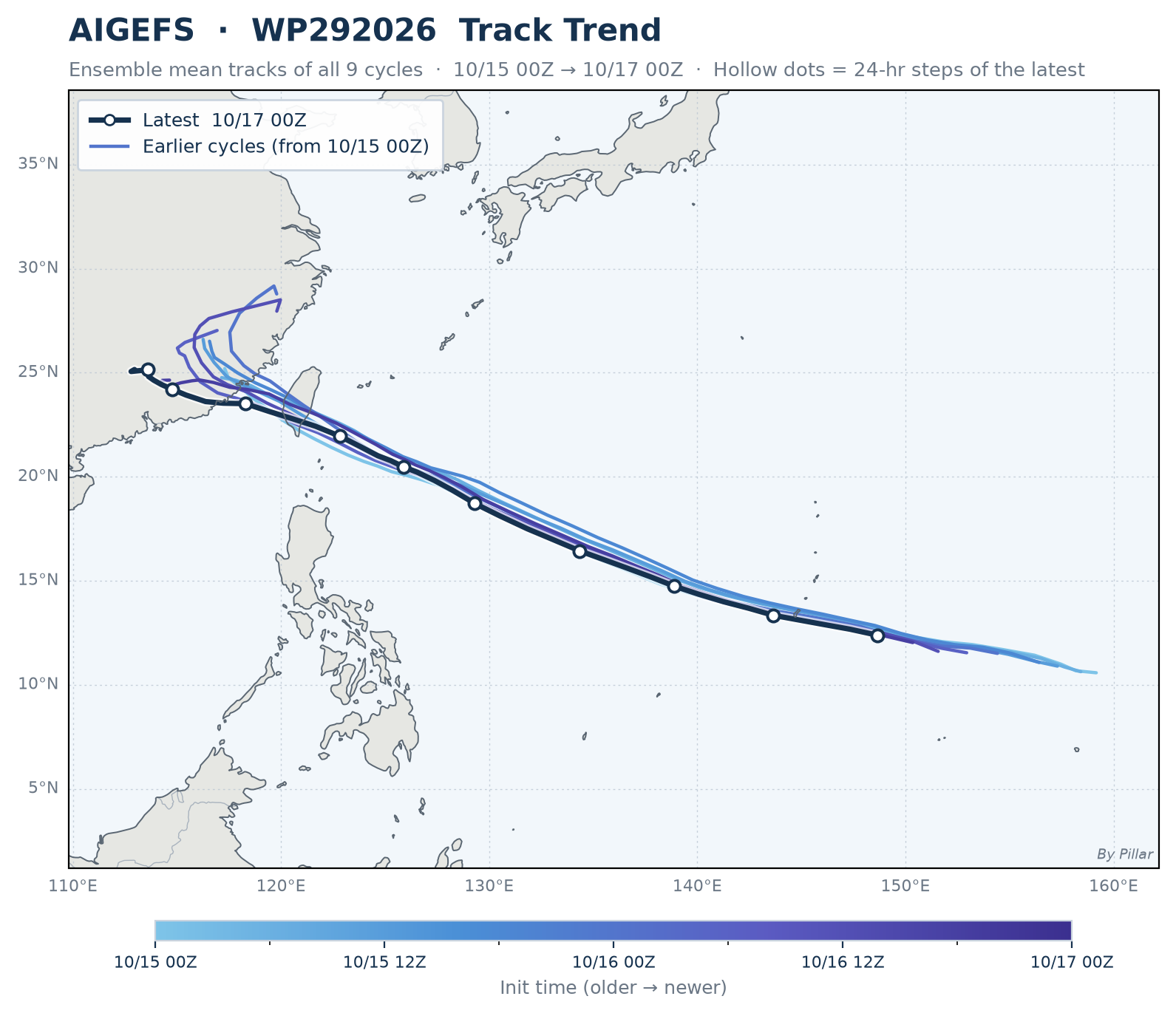
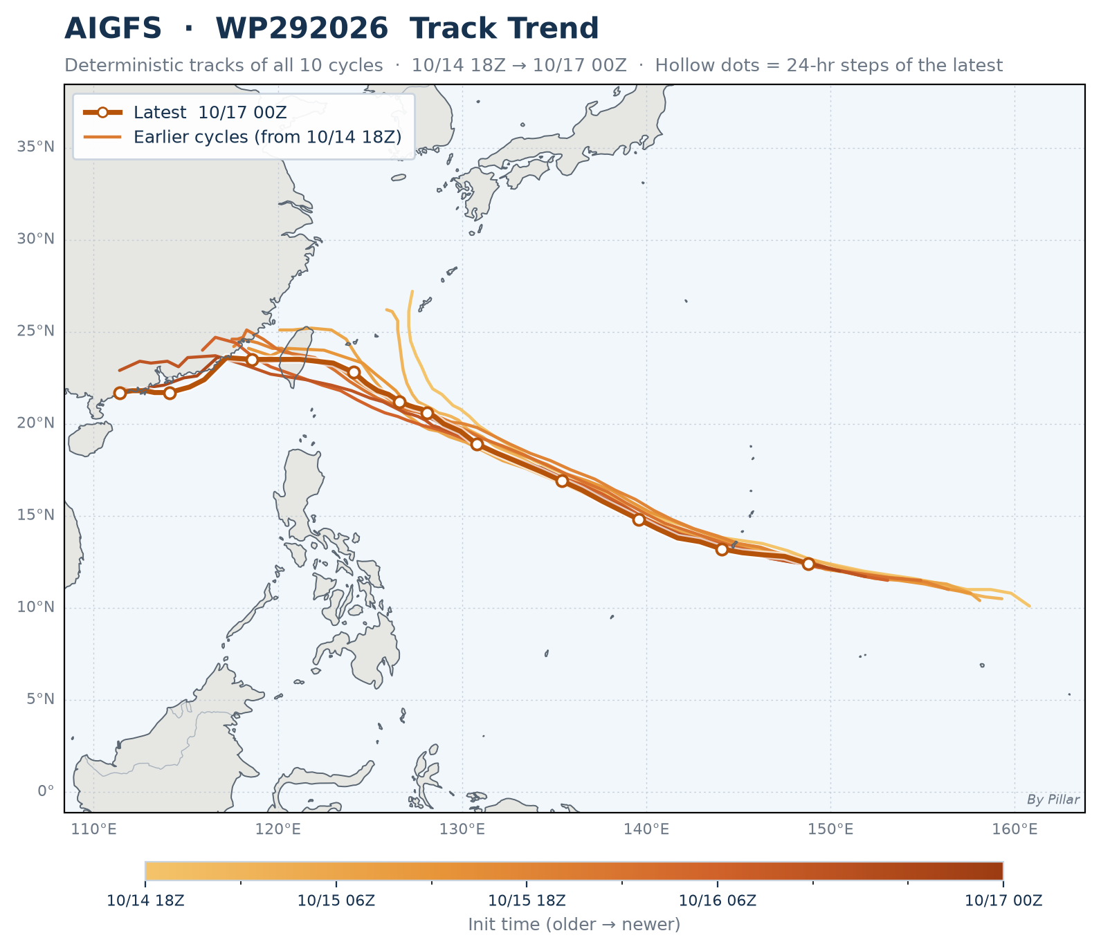
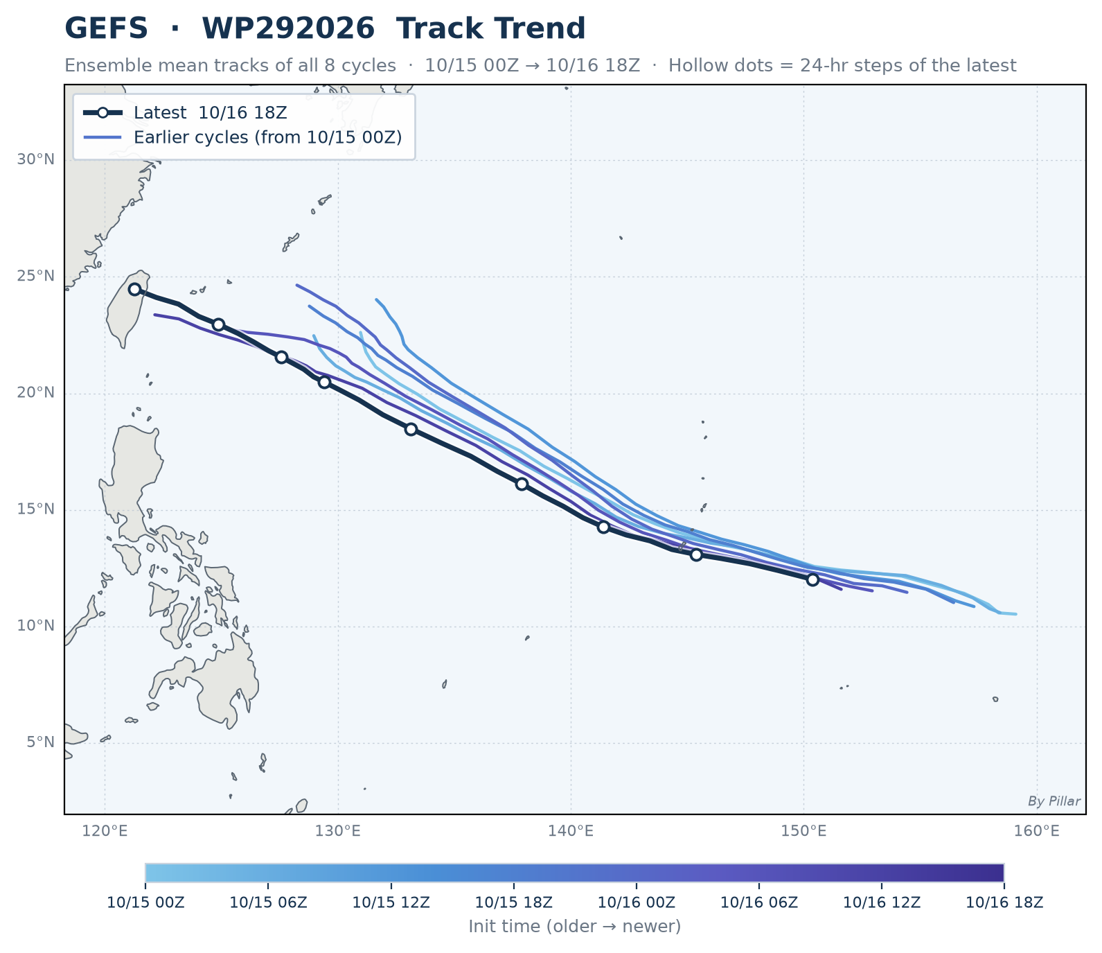
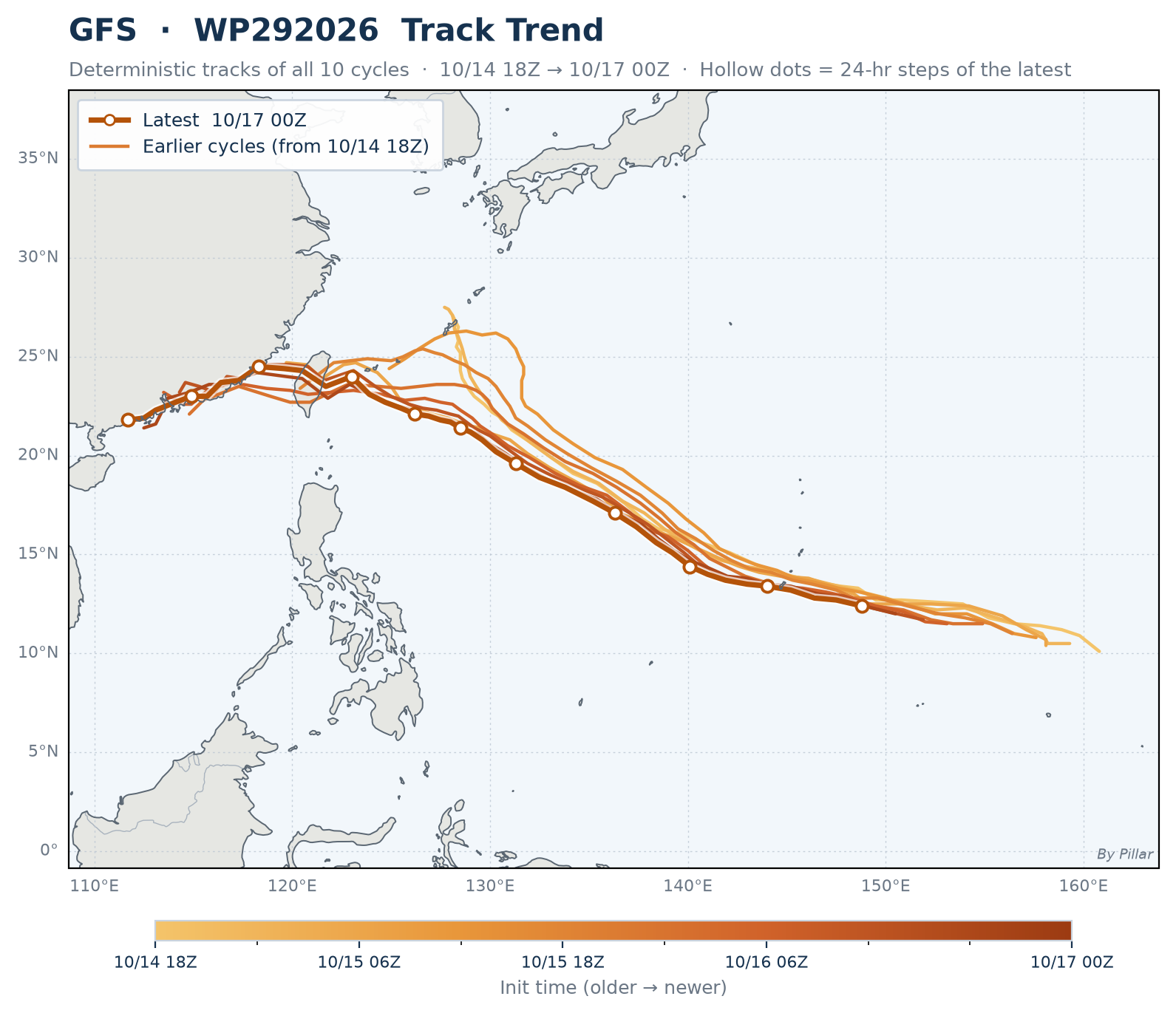
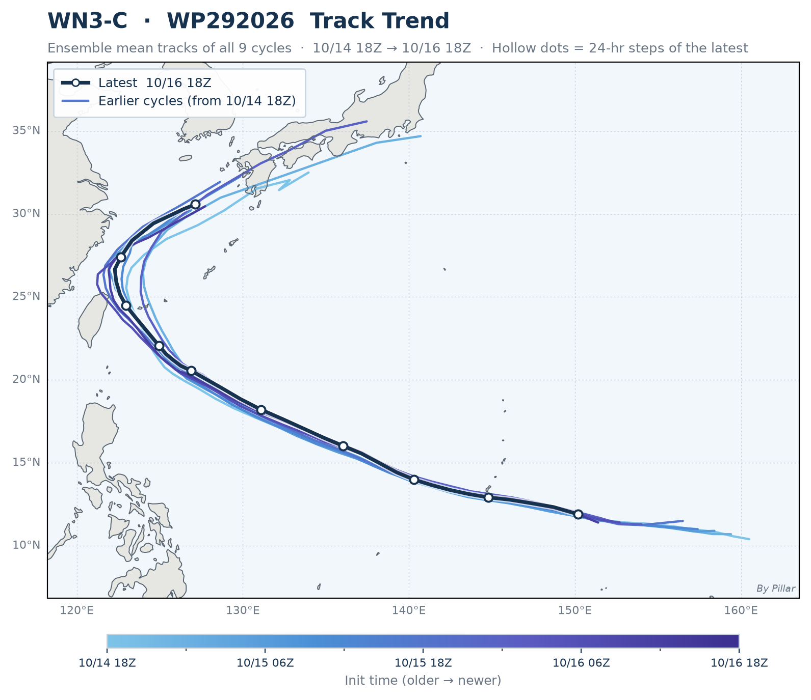
Ensemble mean tracks from every cycle since the storm first appeared, older = lighter · Shows which way successive forecasts have shifted · AIFS-single / ECMWF HRES / AIGFS / GFS tabs = deterministic run (amber)
 🔍 Click to enlarge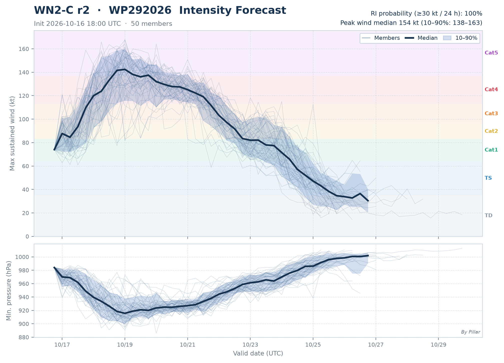
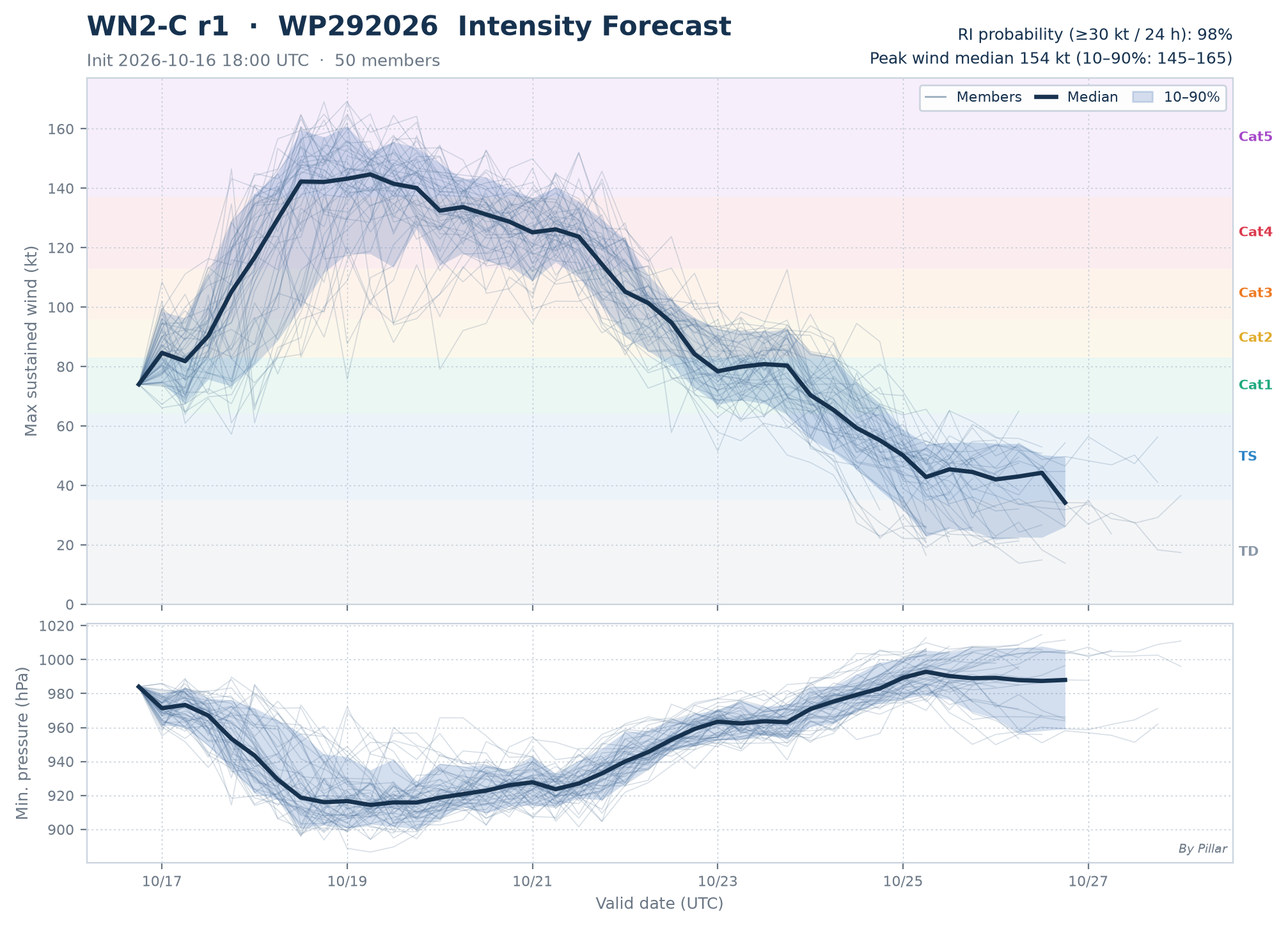
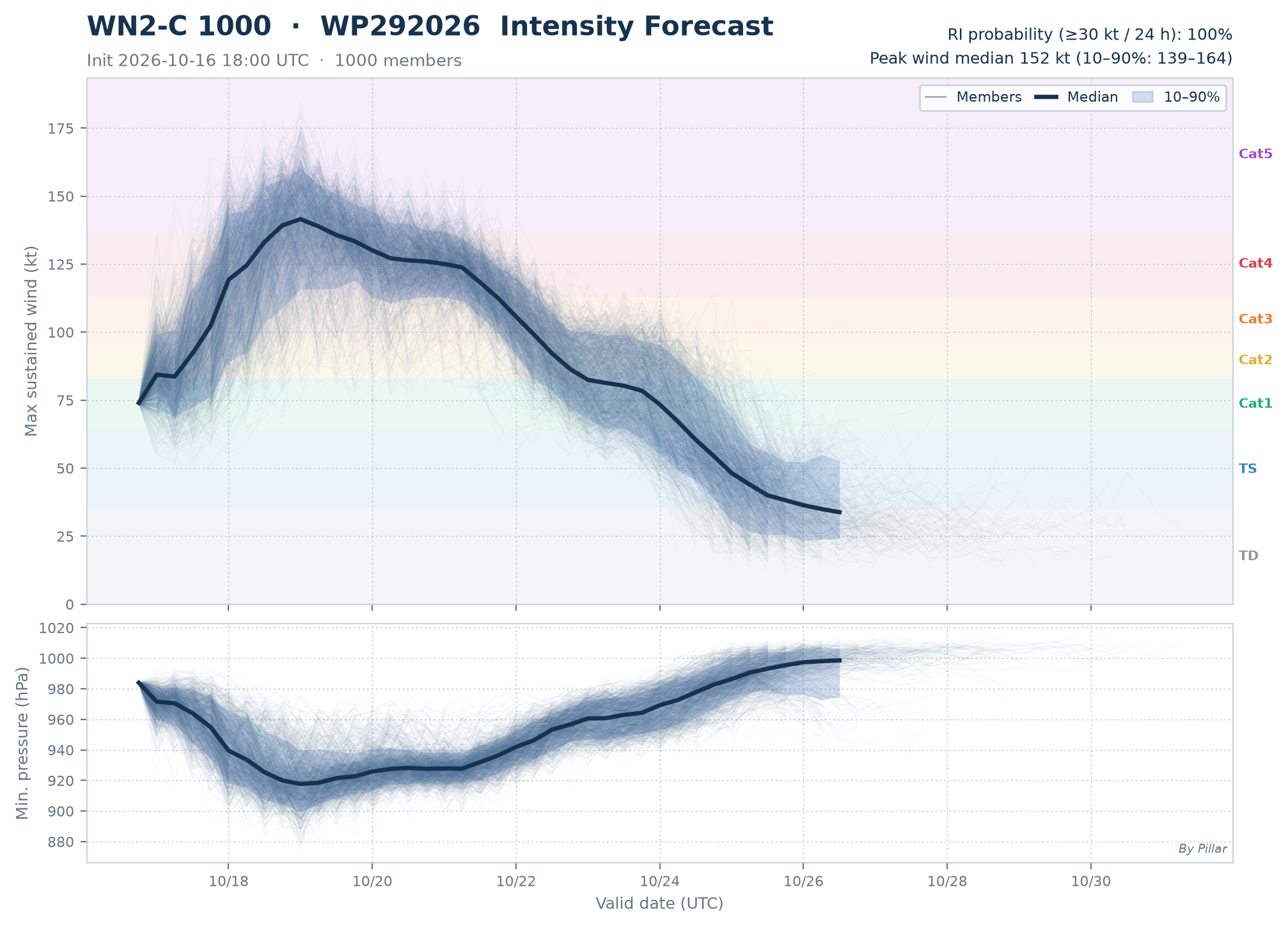
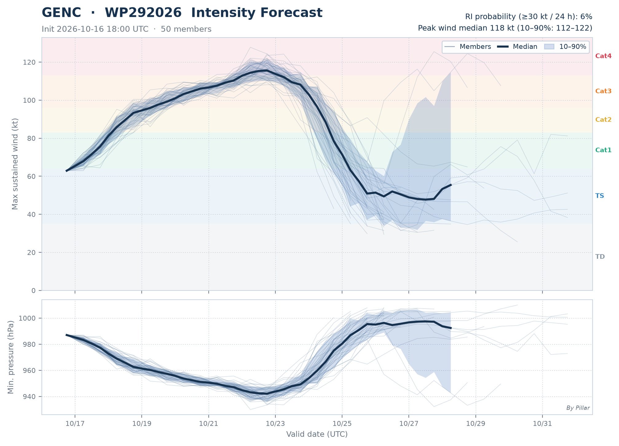
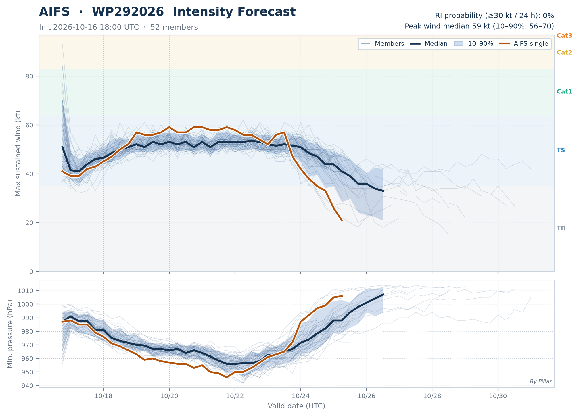
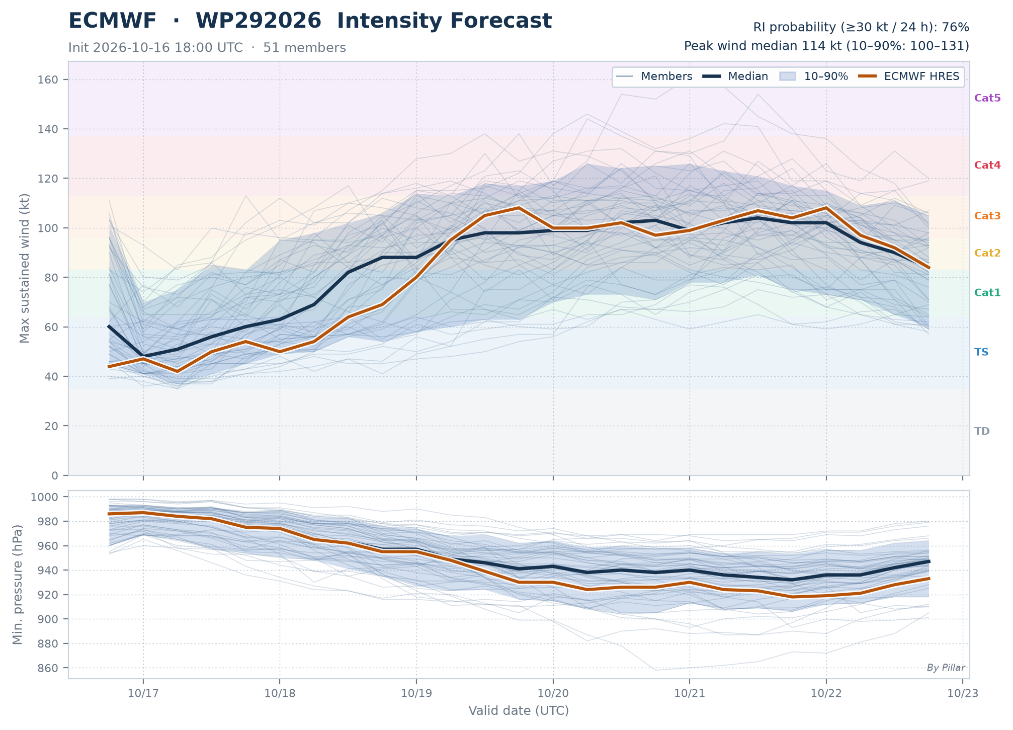
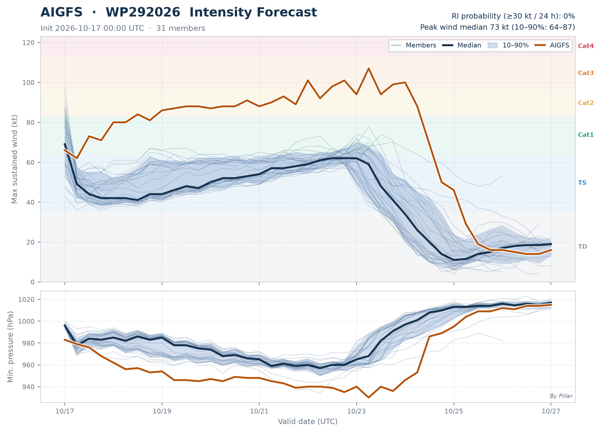
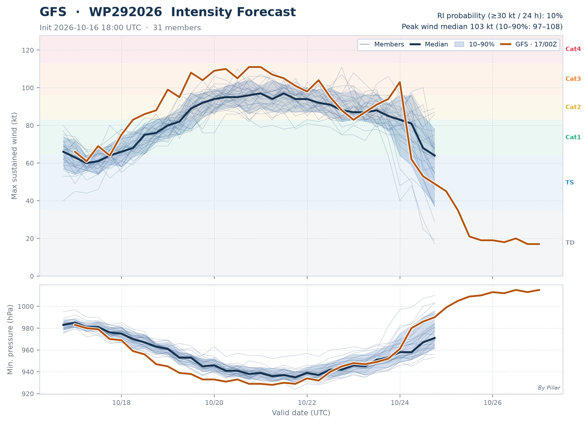
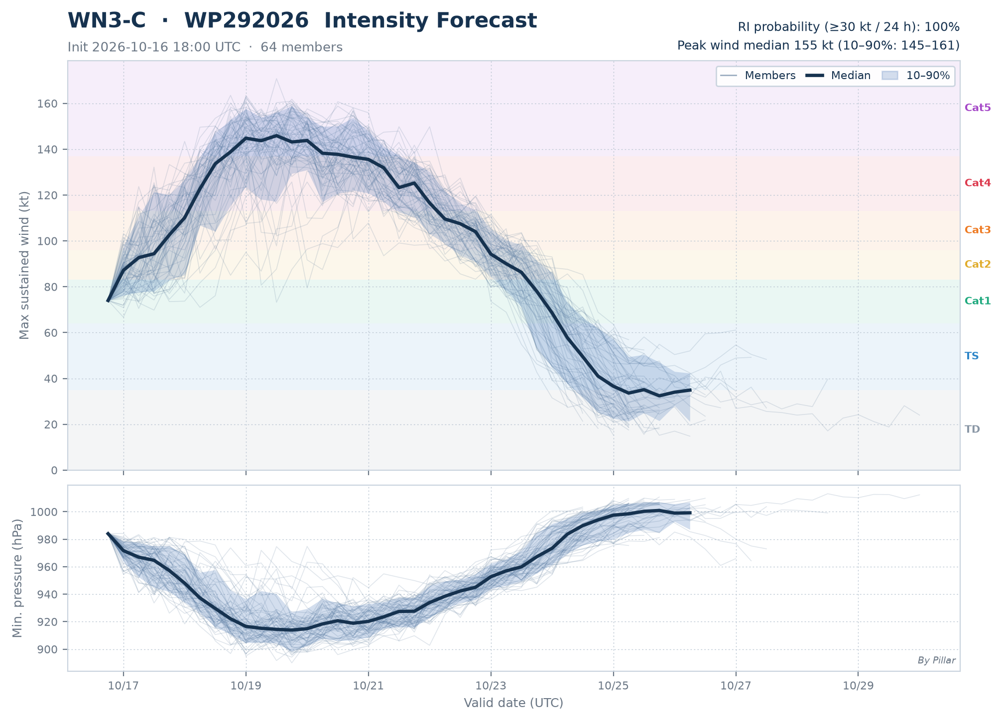
Thin lines = members · Navy line = median · Band = 10–90% · RI = intensifying ≥ 30 kt within 24 h · Amber line = deterministic run (AIFS / ECMWF / AIGFS / GFS)
Every model has every forecast so far, so the homogeneous and full samples are identical and shown once.
Only this storm has verified forecasts so far, so it matches the all-storms total.
| Model | 24 hkm | 48 hkm | 72 hkm | 96 hkm | 120 hkm |
|---|---|---|---|---|---|
| Ensemble mean | |||||
| WN3-C | 27n=6 · +4% | 24n=2 | — | — | — |
| WN2-C r2 | 32n=6 · +23% | 28n=2 | — | — | — |
| WN2-C r1 | 26n=6 · ★ | 22n=2 | — | — | — |
| GENC | 29n=6 · +12% | 45n=2 | — | — | — |
| AIFS-ENS | 44n=6 · +69% | 54n=2 | — | — | — |
| ECMWF-ENS | 88n=6 · +238% | 204n=2 | — | — | — |
| AIGEFS | 88n=5 · +238% | 41n=1 | — | — | — |
| GEFS | 155n=5 · +496% | 202n=1 | — | — | — |
| Deterministicsingle run — usually less accurate than an ensemble mean | |||||
| AIFS-single | 35n=6 · +35% | 52n=2 | — | — | — |
| ECMWF HRES | 67n=6 · +158% | 186n=2 | — | — | — |
| AIGFS | 78n=6 · +200% | 54n=2 | — | — | — |
| GFS | 119n=6 · +358% | 134n=2 | — | — | — |
Mean distance (km) between each forecast position and the JTWC warning position at the same time · Homogeneous = only forecasts every model has for the same storm, init and hour (fair comparison) · Colors compare models per hour: green = best, red = worst; ★ = best, +x% = behind the best · Faded = fewer than 3 forecasts, not ranked
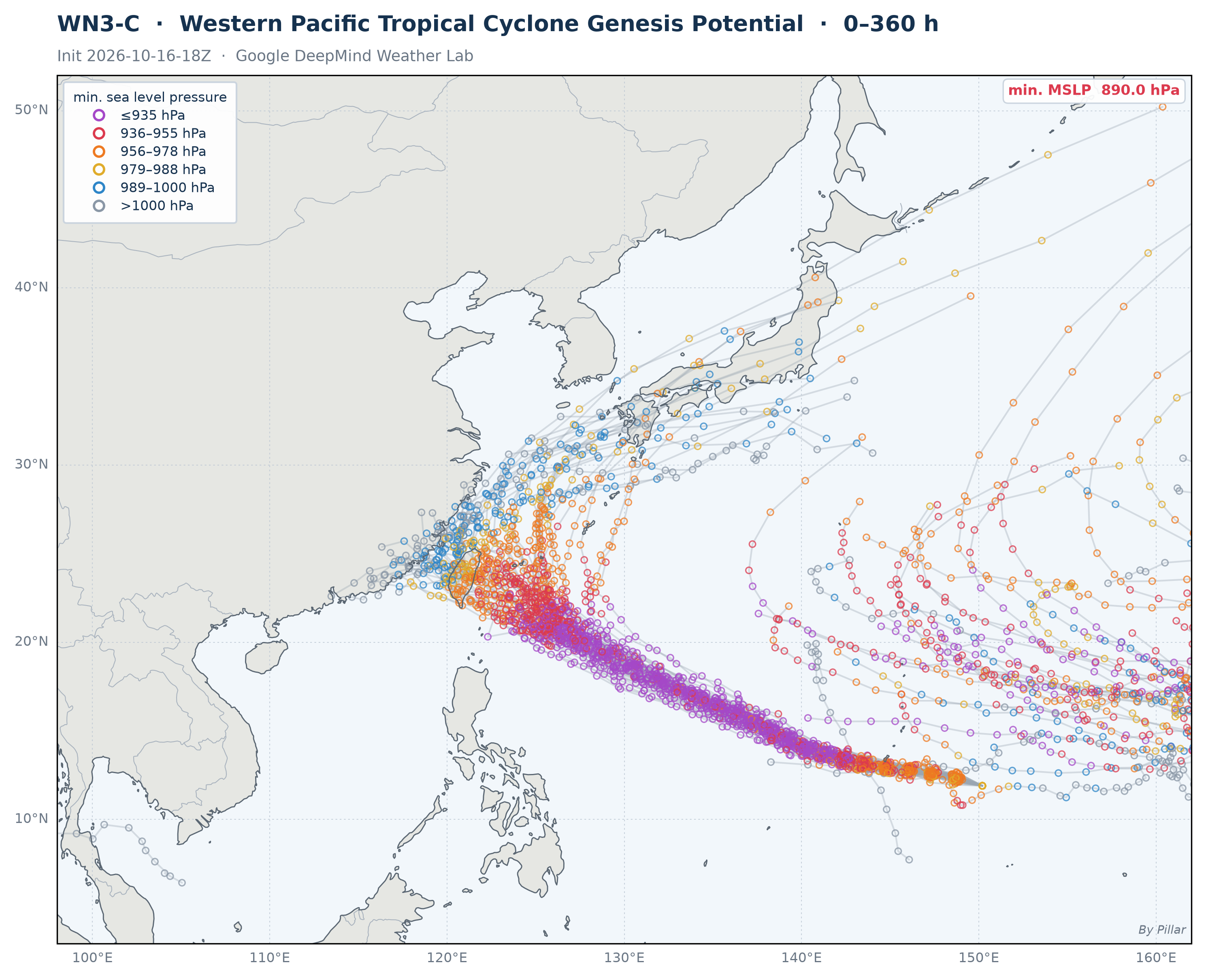
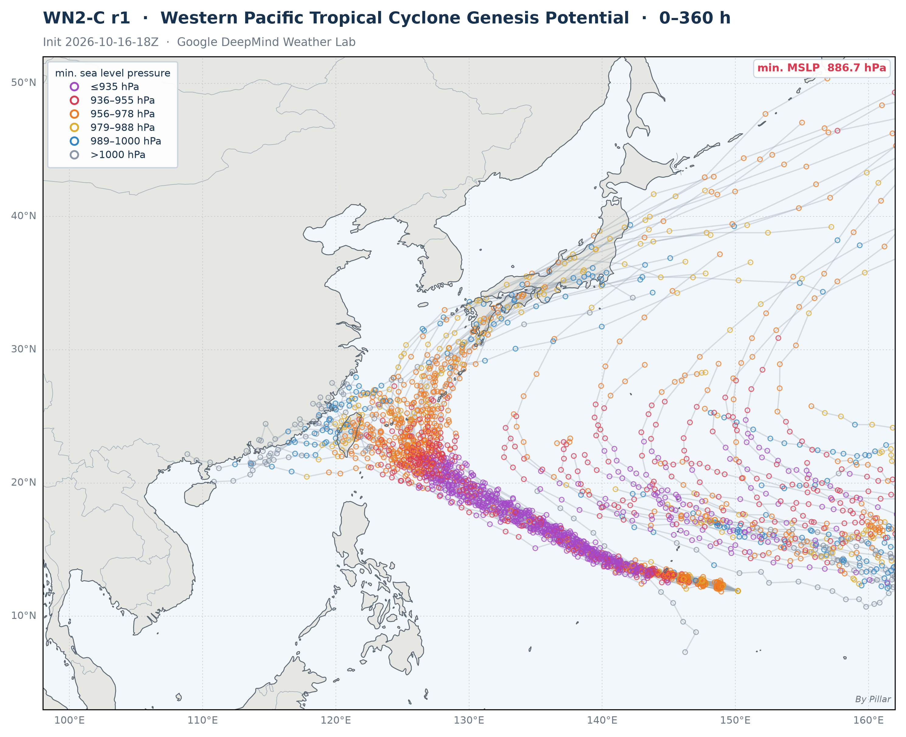
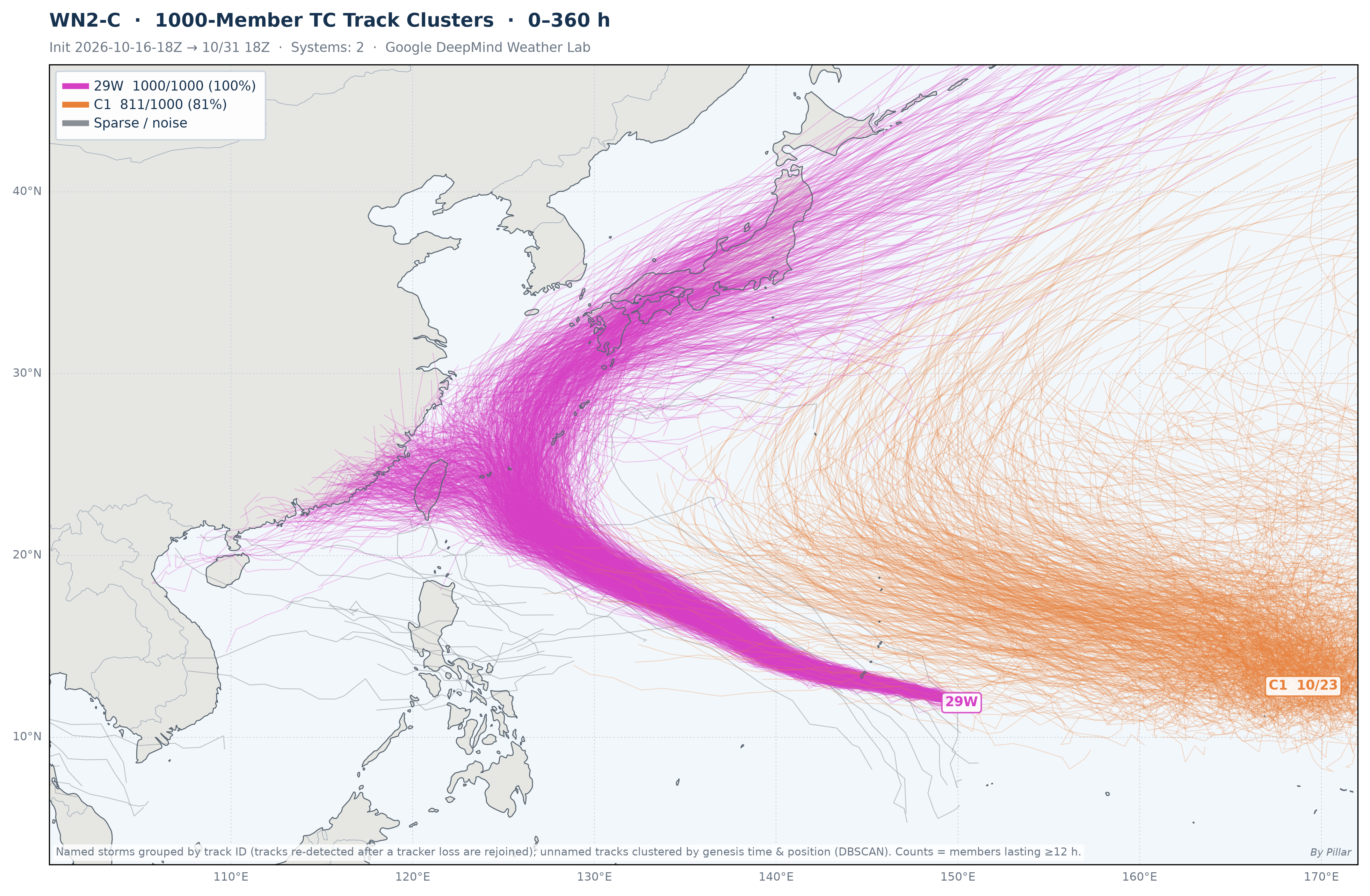
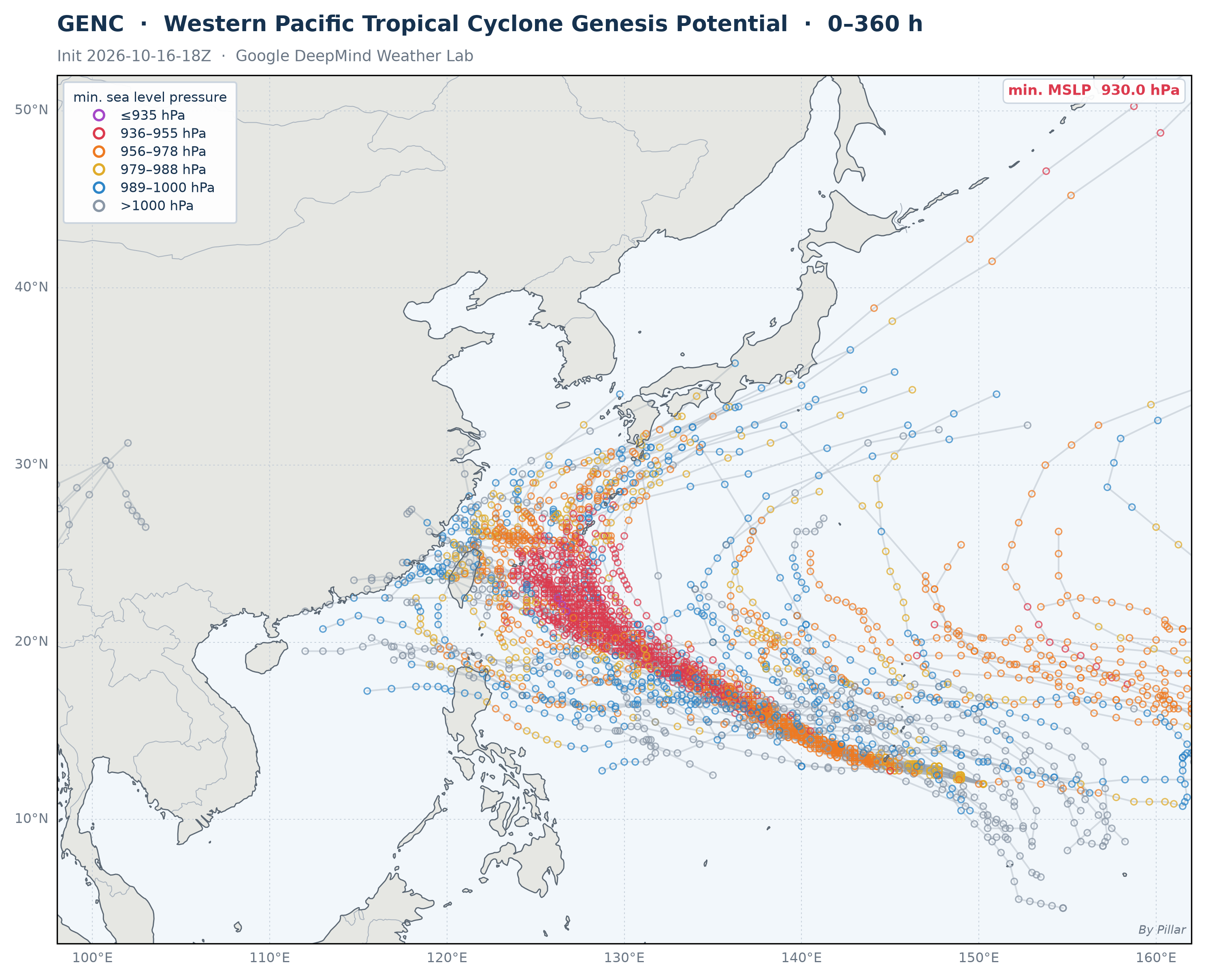
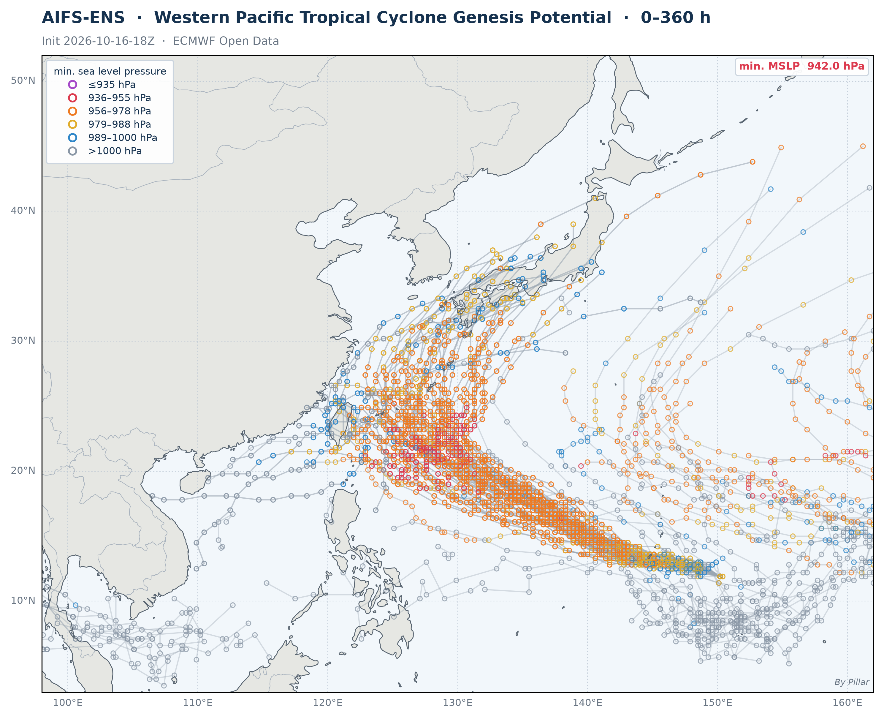
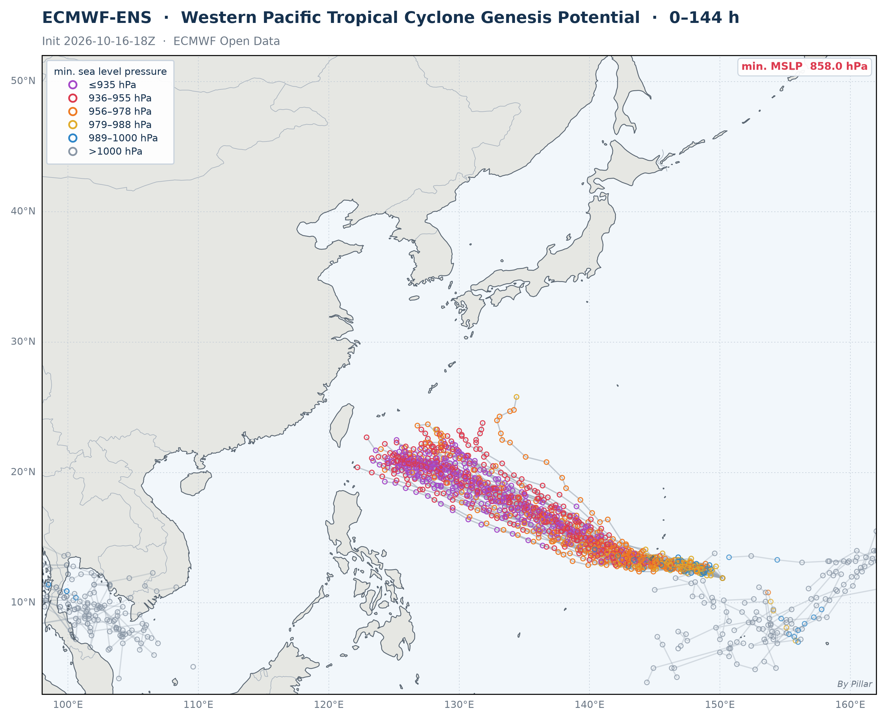
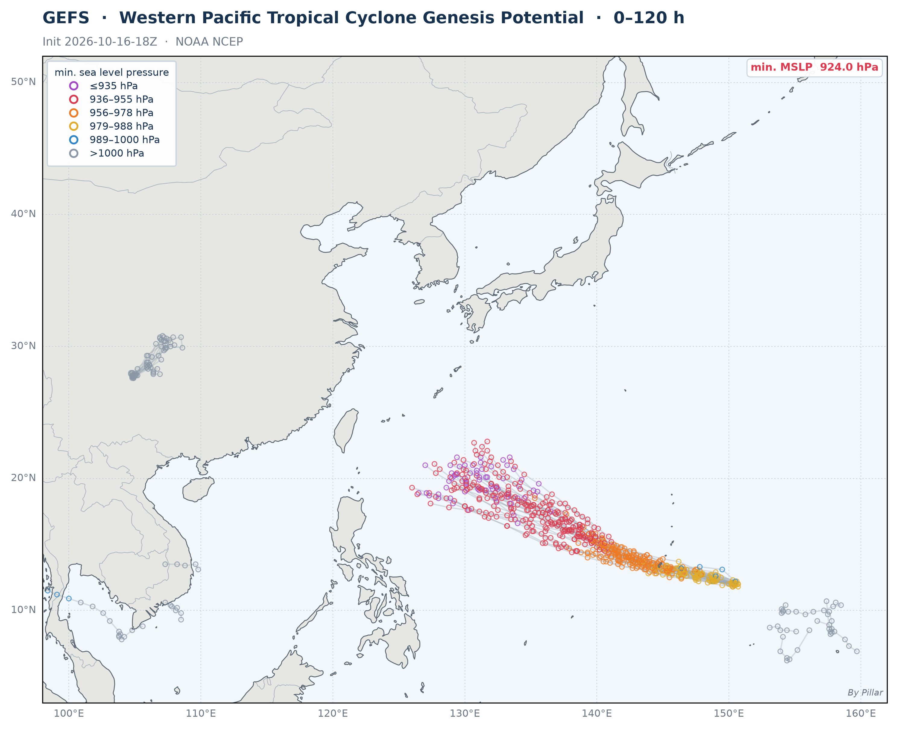
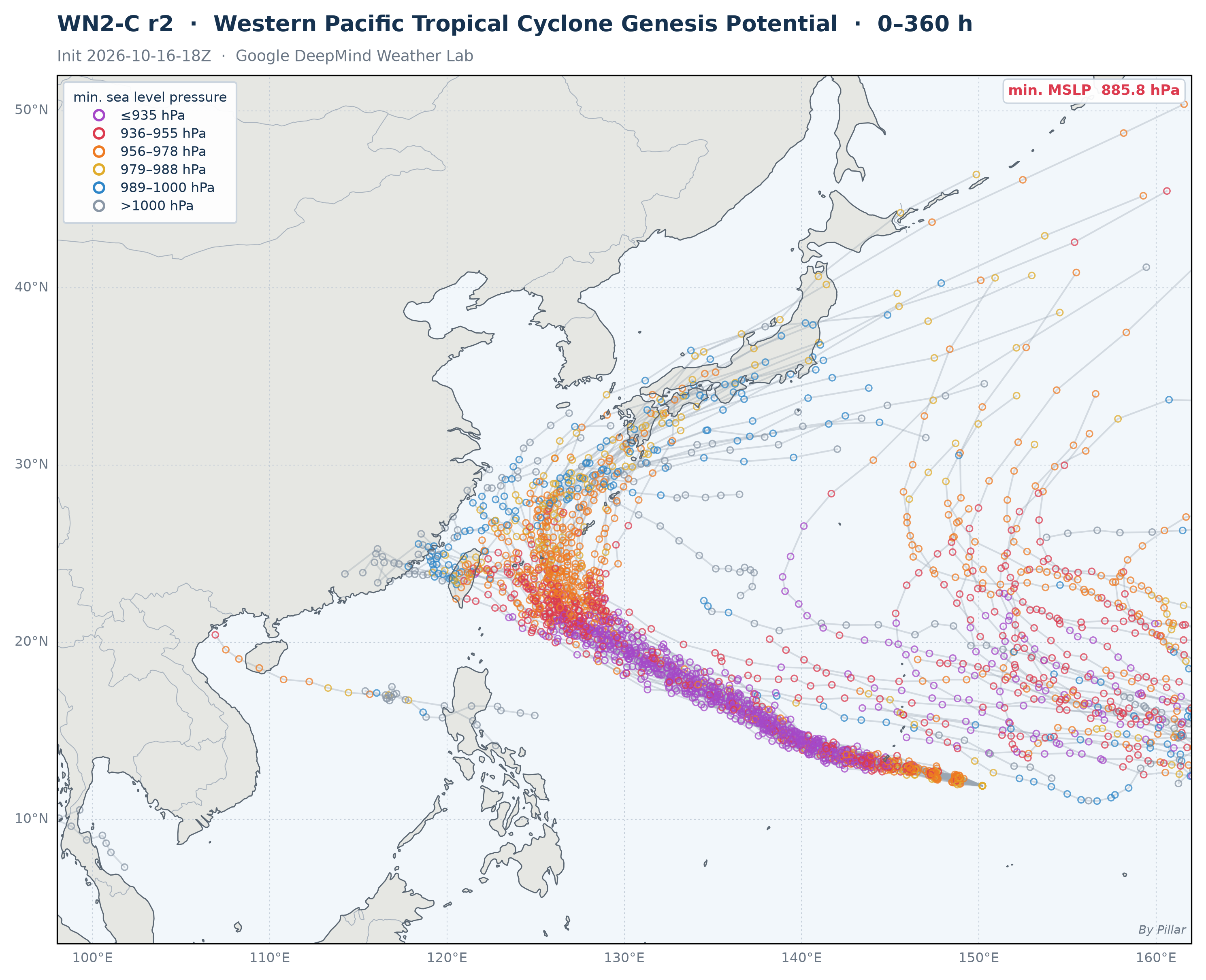
Western Pacific Tropical Cyclone Genesis Potential — Ensemble Overview
 🔍 Click to enlarge
Circles = ensemble members at each 6-hr step, colored by minimum sea level pressure. Gray lines = individual ensemble tracks (up to 360 h; GEFS 120 h). Data sourced from Google DeepMind WN3-C.
How to read this site
This site gathers AI and physics-based ensemble forecasts for Western Pacific tropical cyclones and redraws them on a common style every 10 minutes, next to the official JTWC forecast.
Multi-Model Comparison
Track Evolution Animation
Ensemble Track Forecast
Interactive Track Map
Strike Probability
Strike Probability by Period
Taiwan Landfall & City Strike Probability
Track Trend
Intensity Forecast
Track Error by Model
Genesis
Not for operational use. For official warnings, follow your national meteorological agency.
Probabilities on this site are the share of ensemble members that forecast an outcome — a measure of how much the models agree, not an official forecast probability. A deterministic run (AIFS-single, ECMWF HRES, AIGFS, GFS) is a single possible scenario.